USGS Geoscience Data Catalog
Additional USGS Geoscience data can be found by geographic location or by publication series.
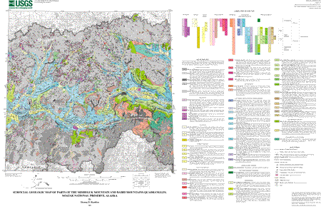
Hamilton, T.D., 2003, Surficial geologic map of parts of the Misheguk Mountain and Baird Mountains quadrangles, Noatak National Preserve, Alaska: U.S. Geological Survey Open-File Report 03-367.Online Links:
This is a Vector data set.
Planar coordinates are encoded using coordinate pair
Abscissae (x-coordinates) are specified to the nearest 250
Ordinates (y-coordinates) are specified to the nearest 250
Planar coordinates are specified in meters
| Value | Definition |
|---|---|
| 1 | Stratigraphic contact; location certain |
| 2 | Stratigraphic contact; location approximate |
| 4 | Normal fault; location certain |
| 7 | Water boundary |
| 9 | Hidden line used to close polygon |
| 13 | Crest of morainal ridge |
| 30 | Fault, location certain |
| 51 | Stratigraphic contact; location concealed |
| 98 | Boundary of mapped area |
| 99 | Bounding line of coverage |
| 101 | Drainage channel; abandoned or underfit |
| 104 | Erosional scarp |
| Value | Definition |
|---|---|
| CONTACT; CERTAIN | Stratigraphic contact |
| CONTACT; APPROXIMATE | Stratigraphic contact |
| NORMAL FAULT; CERTAIN | Normal fault |
| WATER BOUNDARY | Water boundary |
| HIDDEN | Arc which does not appear on the printed map |
| MORAINE | Glacial moraine |
| FAULT | Fault |
| CONTACT; CONCEALED | Stratigraphic contact |
| NOATAK PRESERVE BOUNDARY | Boundary of area mapped |
| QUAD BOUNDARY | Boundary of the quadrangle |
| DRAINAGE CHANNEL | Drainage channel |
| EROSIONAL SCARP | Erosional scarp |
| Value | Definition |
|---|---|
| 98 | Unmapped area |
| 102 | Water |
| 103 | B - Bedrock, undifferentiated |
| 105 | (B) - Discontinuous bedrock, undifferentiated |
| 106 | Ba - Bedrock, alpine |
| 107 | Be - Bedrock exposed by erosion |
| 109 | Bg - Bedrock, glaciated |
| 110 | Bg? - Possible bedrock, glaciated |
| 113 | Bs - Bedrock, silt-covered |
| 115 | af - Deposits of steep alpine fans |
| 116 | afi - Inactive alpine fan deposits |
| 117 | f - Fan deposits |
| 118 | fi - Inactive fan deposits |
| 119 | al - Alluvium, undivided |
| 121 | al2 - Modern alluvium |
| 123 | al1 - Low alluvial-terrace deposits |
| 125 | gr - Gravel deposits, undifferentiated |
| 126 | gr? - Possible gravel deposits, undiferentiated |
| 127 | tg - Terrace gravel |
| 128 | tg? - Possible terrace gravel |
| 129 | tg1 - Terrace gravel, highest-level |
| 131 | tg2 - Terrace gravel, intermediate-level |
| 132 | tg2? - Possible terrace gravel, intermediate-level |
| 133 | tg3 - Terrace gravel, low-level |
| 135 | c - Colluvium, undivided |
| 136 | (c) - Thin and generally discontinuous colluvium, undivided |
| 137 | s - Solifluction deposits |
| 138 | (s) - Thin and generally discontinuous solifluction deposits |
| 139 | ls - Landslide deposits |
| 140 | ls? - Possible landslide deposits |
| 141 | pr - Protalus rampart deposits |
| 143 | rg - Rock-glacier deposits, undifferentiated |
| 145 | rga - Rock-glacier deposits, active |
| 147 | rgi - Rock-glacier deposits, inactive |
| 148 | tr - Talus rubble |
| 149 | tra - Talus rubble, active |
| 151 | tri - Talus rubble, inactive |
| 153 | si - Ice-rich silt deposits |
| 155 | us - Upland silt deposits |
| 156 | (us) - Thin and generally discontinuous upland silt deposits |
| 157 | l - Lacustrine deposits |
| 159 | tl - Thaw-lake deposits |
| 161 | igl - Glacial-lake deposits of Itkillik age |
| 162 | igl1 - Glacial-lake deposits of Anisak (Itkillik Phase IB) age |
| 163 | igl2 - Glacial-lake deposits of Avan (Itkillik Phase II) age |
| 164 | igl2? - Possible glacial-lake deposits of Avan (Itkillik Phase II) age |
| 165 | d - Drift, undifferentiated |
| 166 | d? - Possible drift, undifferentiated |
| 167 | nd - Drift of neoglacial age |
| 169 | id - Drift of Itkillik age, undifferentiated |
| 170 | Heavily eroded portion of unit id |
| 171 | id3 - Drift of late Avan (late Itkillik Phase II) readvance |
| 172 | id3? - Possible drift of late Avan (late Itkillik Phase II) readvance |
| 173 | id2 - Drift of Avan (Itkillik Phase II) age |
| 174 | id2? - Possible drift of Avan (Itkillik Phase II) age |
| 175 | id1 - Drift of Itkillik Phase I, undivided |
| 176 | id1C - Drift of late Aniuk (Itkillik Phase IC) age |
| 177 | ik - Ice-stagnation (kame) deposits |
| 179 | io - Outwash of Itkillik age, undivided |
| 180 | io1 - Outwash of Itkillik Phase I |
| 181 | io3 - Outwash of late Avan (late Itkillik Phase II) readvance |
| 183 | io2 - Outwash of Avan (Itkillik Phase II) age |
| 184 | io2? - Possible outwash of Avan (Itkillik Phase II) age |
| 187 | sd - Drift of Cutler (Sagavanirktok River) age |
| 188 | (sd) - Thin and generally discontinuous drift of Cutler (Sagavanirktok River) age |
| 189 | so - Outwash of Cutler (Sagavanirktok River) age |
| 190 | (igl) - Thin and generally discontinuous glacial-lake deposits of Itkillik age |
| 191 | (d)? - Thin and generally discontinuous possible drift, undifferentiated |
| 192 | (d) - Thin and generally discontinuous drift, undifferentiated |
| 193 | fa - Active fan deposits |
| 194 | sd? - Possible drift of Cutler (Sagavanirktok River) age |
| 195 | sgl - Glacial-lake deposits of Anisak (Itkillik Phase IB) age |
| 196 | idt - Deltaic deposits of Itkillik age |
| 197 | Heavily eroded portion of unit sd |
| 198 | sgl/sd - Glacial-lake deposits of Anisak (Itkillik Phase IB) age over drift of Cutler (Sagavanirktok River) age |
| 199 | us/d - Upland silt deposits over drift, undifferentiated |
| 200 | i-c - Ice-contact meltwater deposits |
| 201 | igl/B - Glacial-lake deposits of Itkillik age over bedrock, undifferentiated |
| 202 | (id) - Thin and generally discontinuous drift of Itkillik age, undifferentiated |
| 203 | id1A - Drift of Makpik (Itkillik Phase IA) age |
| 204 | id1B - Drift of Aniuk (Itkillik Phase IB) age |
| 205 | igl2/B - Glacial-lake deposits of Avan (Itkillik Phase II) age over bedrock, undifferentiated |
| 207 | igl? - Possible glacial-lake deposits of Itkillik age |
| 208 | (id2) - Thin and generally discontinuous drift of Avan (Itkillik Phase II) age |
| 209 | (tg) - Thin and generally discontinuous terrace gravel |
| 210 | idt? - Possible deltaic deposits of Itkillik age |
| 211 | igl1/io1 - Glacial-lake deposits of Anisak (Itkillik Phase IB) age over outwash of Itkillik Phase I |
| 212 | igl/io1 - Glacial-lake deposits of Itkillik age over outwash of Itkillik Phase I |
| 213 | us/d - Upland silt deposits over drift, undifferentiated |
| 214 | igl/io2 - Glacial-lake deposits of Itkillik age over outwash of Avan (Itkillik Phase II) age |
| 215 | igl2/io2? - Glacial-lake deposits of Avan (Itkillik Phase II) age over possible outwash of Avan (Itkillik Phase II) age |
| 216 | igl2/id - Glacial-lake deposits of Avan (Itkillik Phase II) age over drift of Itkillik age, undifferentiated |
| 217 | b? - Possible beach deposits |
| 219 | id1? - Possible drift of Itkillik age, undifferentiated |
| 220 | igl2/id1 - Glacial-lake deposits of Avan (Itkillik Phase II) age over drift of Itkillik Phase I, undivided |
| 221 | id? - Possible drift of Itkillik age, undifferentiated |
| 222 | igl1? - Possible glacial-lake deposits of Anisak (Itkillik Phase IB) age |
| 223 | s/id? - Solifluction deposits over possible drift of Itkillik age, undifferentiated |
| 224 | igl2/d - Glacial-lake deposits of Avan (Itkillik Phase II) age over drift, undifferentiated |
| 225 | igl/id1 - Glacial-lake deposits of Itkillik age over drift of Itkillik Phase I, undivided |
| 226 | b - Beach deposits |
| 227 | id1B? - Possible drift of Aniuk (Itkillik Phase IB) age |
| 228 | io? - Possible outwash of Itkillik age, undivided |
| 229 | (id1B) - Thin and generally discontinuous drift of Aniuk (Itkillik Phase IB) age |
| 230 | igl/id1A - Glacial-lake deposits of Itkillik age over drift of Makpik (Itkillik Phase IA) age |
| 231 | igl/id1B - Glacial-lake deposits of Itkillik age over drift of Aniuk (Itkillik Phase IB) age |
| 232 | igl1/id - Glacial-lake deposits of Anisak (Itkillik Phase IB) age over drift of Itkillik age, undifferentiated |
| 233 | igl2/id1B - Glacial-lake deposits of Avan (Itkillik Phase II) age over drift of Aniuk (Itkillik Phase IB) age |
| 234 | igl2/id2 - Glacial-lake deposits of Avan (Itkillik Phase II) age over drift of Avan (Itkillik Phase II) age |
| 235 | cm - Collumium-filled mountain valley |
| 236 | rg? - Possible rock-glacier deposits, undifferentiated |
| 237 | (io) - Thin and generally discontinuous outwash of Itkillik age, undivided |
| 238 | igl2/id1A - Glacial-lake deposits of Avan (Itkillik Phase II) age over drift of Makpik (Itkillik Phase IA) age |
| 239 | so? - Possible outwash of Cutler (Sagavanirktok River) age |
| 240 | (id1)? - Thin and generally discontinuous possible drift of Itkillik age, undifferentiated |
| 241 | igl2/id1A? - Glacial-lake deposits of Avan (Itkillik Phase II) age over possible drift of Makpik (Itkillik Phase IA) age |
| 242 | igl1/id1 - Glacial-lake deposits of Anisak (Itkillik Phase IB) age over drift of Itkillik Phase I, undivided |
| 243 | Aufeis zone of unit al |
| 244 | io1B - Outwash of Aniuk (Itkillik Phase IB) age |
| 245 | (id1) - Thin and generally discontinuous drift of Itkillik Phase I, undivided |
| 246 | Altiplanation terrace |
| 247 | fd - Fan-delta deposits |
| 248 | fl - Flow deposits |
| 249 | igl1/id1A - Glacial-lake deposits of Anisak (Itkillik Phase IB) age over drift of Makpik (Itkillik Phase IA) age |
| 250 | dt - Deltaic deposits |
| 251 | sdt - Deltaic deposits of Cutler (Sagavanirktok River) age |
| 252 | id1C? - Possible drift of late Aniuk (Itkillik Phase IC) age |
| 253 | io1C? - Possible outwash of late Aniuk (late Itkillik Phase IB) age |
| 254 | s/igl1 - Solifluction deposits over glacial-lake deposits of Anisak (Itkillik Phase IB) age |
| 255 | igl1/id1B - Glacial-lake deposits of Anisak (Itkillik Phase IB) age over drift of Aniuk (Itkillik Phase IB) age |
| 256 | al/igl - Alluvium, undivided over glacial-lake deposits of Itkillik age |
| 257 | rgi? - Possible rock-glacier deposits, inactive |
| 258 | Aufeis zone of unit al2 |
| 259 | (sd)? - Thin and generally discontinuous possible drift of Cutler (Sagavanirktok River) age |
| 260 | igl2/io2? - Glacial-lake deposits of Avan (Itkillik Phase II) age over possible outwash of Avan (Itkillik Phase II) age |
| 261 | igl/tg - Glacial-lake deposits of Itkillik age over terrace gravel |
| 262 | io1C - Drift of late Aniuk (Itkillik Phase IC) age |
| 263 | tg4 - Terrace gravel, lowest-level |
| 264 | od - Older drift |
| Value | Definition |
|---|---|
| 0 | Not a compound unit |
| 1 | Compound unit |
| Value | Definition |
|---|---|
| 1 | Arrow with solid head; Direction of glacier flow across topographic divide |
| 2 | Arrow with solid head with a circle over the tail; Direction of ice movement or meltwater drainage |
| 3 | Arrow with open head; Former meltwater flow direction |
| 4 | Two parallel brackets; U-shaped pass - Where glacier crossed topographic divide |
This digital coverage was created by Keith Labay, SAIC contractor.
907-786-7451 (voice)
thamilto@usgs.gov
Digital representation of geologic mapping facilitates the presentation and analysis of earth-science data. Digital maps may be displayed at any scale or projection, however the geologic data in this coverage is not intended for use at a scale larger than 1:250,000.
Person who carried out this activity:
907-786-7410 (voice)
klabay@usgs.gov
The linework was captured by scanning an inked greenline overlay to create a TIFF that was then heads up digitized. After digitizing the file was attributed in ARC/INFO. The digital data has been visually checked against the original.
Users of this digital geologic map should respect the intentions of the original mappers and the limitations of the map. This geologic map compilation is intended to be used at a scale of 1:250,000; it is not intended to be used at a more detailed scale.
These coverages were used to create the map portion of 03-367. Text files, tables, graphics, symbolsets, and topography shown on the map sheet are not included.
Coverage noatakgeol is a network coverage containing
arcs and polygons. Each polygon has a coded attribute
designating the mapped geologic unit. Stratigraphic contacts
and water boundaries are represented as arcs. There are
two associated info files noatakgeol.lut and noatakgeol.lut2 that were
used to assign symbols, overprints, and labels when plotting
from ARC/INFO.
Coverage noatak_pnt is a point coverage used to place
symbols for directional arrows and passes.
Are there legal restrictions on access or use of the data?
- Access_Constraints: None
- Use_Constraints:
- Acknowledgement of the U.S. Geological Survey would be appreciated in products derived from this data.
303-202-4200 or 1-888-ASK-USGS (voice)
USGS Open-File Report 03-367
Although this data has been used by the USGS, no warranty, expressed or implied, is made by the USGS as to the accuracy of the data and related materials. The act of distribution shall not constitute any such warranty, and no responsibility is assumed by the USGS in the use of these data, software, or related materials.
| Data format: | Geologic units and structural features in format ArcInfo export (version 7.2.1) Size: 986 kilobytes |
|---|---|
| Network links: |
<http://geopubs.wr.usgs.gov/open-file/of03-367/of367.tar.gz> |
907-786-7410 (voice)
klabay@usgs.gov

![]() U.S. Department of the Interior |
U.S. Geological Survey
U.S. Department of the Interior |
U.S. Geological Survey
URL: http://geo-nsdi.er.usgs.gov/metadata/open-file/03-367/metadata.faq.html
Page Contact Information: Peter Schweitzer
Page Last Modified: Monday, 10-Nov-2008 12:19:41 EST
