USGS Geoscience Data Catalog
Additional USGS Geoscience data can be found by geographic location or by publication series.
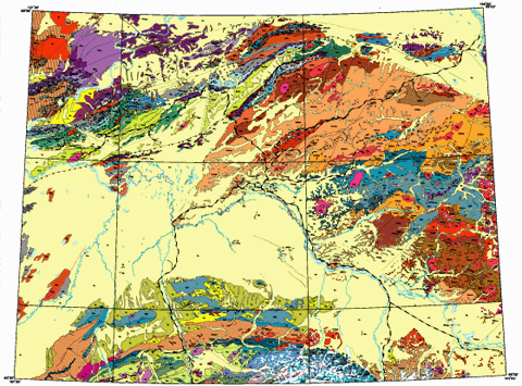
U.S. Geological Survey, 1998, Geologic map of central (interior) Alaska: Digital data: U.S. Geological Survey Open-File Report 98-133a.This is part of the following larger work.Online Links:
Wilson, F.H. (comp.), Dover, J.D. (comp.), Bradley, D.C. (comp.), Weber, F.R. (comp.), Bundtzen, T.K. (comp.), and Haeussler, P.J. (comp.), 1998, Geologic map of Central (Interior) Alaska: U.S. Geological Survey Open-File Report 98-133.
This is a Vector data set.
Planar coordinates are encoded using coordinate pair
Abscissae (x-coordinates) are specified to the nearest 300
Ordinates (y-coordinates) are specified to the nearest 300
Planar coordinates are specified in meters
The ellipsoid used is Clarke 1866.
The semi-major axis of the ellipsoid used is 6378206.4.
The flattening of the ellipsoid used is 1/294.9787.
| Value | Definition |
|---|---|
| 0 | Hidden lines |
| 1 | Stratigraphic contact, certain |
| 2 | Stratigraphic contact, approximate |
| 3 | Stratigraphic contact, inferred, queried |
| 4 | Normal fault, certain, digitized with upthrown side on the right (code of 1 added to ARC-PARA1 where U/D is designated in source) |
| 5 | Normal fault, approximate, digitized with upthrown side on the right (code of 1 added to ARC-PARA1 where U/D is designated in source) |
| 6 | Normal fault, inferred, queried, digitized with upthrown side on the right (code of 1 added to ARC-PARA1 where U/D is designated in source) |
| 7 | Shoreline or riverbank |
| 9 | Boundary of altered zone or hornfels |
| 10 | Thrust fault, certain, teeth on right from origin (angle of thrusting added to ARC-PARA1 where designated in source) |
| 11 | Thrust fault, approx., teeth on right from origin (angle of thrusting added to ARC-PARA1 where designated in source) |
| 12 | Thrust fault, inferred, queried, teeth on right from origin (angle of thrusting added to ARC-PARA1 where designated in source) |
| 13 | Moraine or till margin (scour) on bedrock |
| 14 | Caldera or crater rim |
| 15 | Ice contact (glacier limit) |
| 16 | Thrust fault, having left lateral oblique slip (angle of thrusting added to ARC-PARA1 where designated in source) |
| 17 | Thrust fault, having right lateral oblique slip (angle of thrusting added to ARC-PARA1 where designated in source) |
| 18 | Internal contact |
| 19 | Internal contact having tics on right from origin |
| 21 | Syncline, certain, digitized in direction of plunge |
| 22 | Syncline, approx., digitized in direction of plunge |
| 23 | Syncline, inferred, queried, digitized in direction of plunge |
| 24 | Anticline, certain, digitized in direction of plunge |
| 25 | Anticline, approx., digitized in direction of plunge |
| 26 | Anticline, inferred, queried, digitized in direction of plunge |
| 30 | Fault, unknown offset, certain location |
| 31 | Fault, unknown offset, approximate location |
| 32 | Fault, unknown offset, inferred location |
| 35 | High-angle reverse fault, certain, teeth on right from origin (angle of thrusting added to ARC-PARA1 where designated in source) |
| 36 | High-angle reverse fault, approximate location, teeth on right from origin (angle of thrusting added to ARC-PARA1 where designated in source) |
| 37 | High-angle reverse fault, inferred location, teeth on right from origin (angle of thrusting added to ARC-PARA1 where designated in source) |
| 41 | Syncline, overturned, certain, digitized in direction of plunge. |
| 42 | Syncline, overturned, approx., digitized in direction of plunge. |
| 43 | Syncline, overturned, inferred, queried, digitized in direction of plunge. |
| 44 | Anticline, overturned, certain, digitized in direction of plunge. |
| 45 | Anticline, overturned, approx., digitized in direction of plunge. |
| 46 | Anticline, overturned, inferred, queried, digitized in direction of plunge. |
| 50 | Dikes and sills, drawn in heavy red line. |
| 51 | Concealed contact |
| 52 | Concealed normal fault |
| 53 | Concealed thrust fault |
| 54 | Concealed high-angle reverse fault |
| 55 | Concealed normal fault, having right lateral oblique slip. |
| 56 | Concealed normal fault, having left lateral oblique slip. |
| 57 | Concealed right lateral fault |
| 58 | Concealed left lateral fault |
| 61 | Syncline, certain, no plunge. |
| 62 | Syncline, approx., no plunge. |
| 63 | Syncline, inferred, queried, no plunge. |
| 64 | Anticline, certain, no plunge. |
| 65 | Anticline, approx., no plunge. |
| 66 | Anticline, inferred, queried, no plunge. |
| 71 | Normal fault, certain, having right lateral oblique slip. |
| 72 | Normal fault, approx., having right lateral oblique slip. |
| 73 | Normal fault, certain, having left lateral oblique slip. |
| 74 | Normal fault, approx., having left lateral oblique slip. |
| 75 | Normal fault, inferred, queried, having left lateral oblique slip. |
| 76 | Normal fault, inferred, queried, having right lateral oblique slip. |
| 77 | Fault, certain, having no known movement. |
| 78 | Fault, inferred, queried, having no known movement. |
| 79 | Fault, approx., having no known movement. |
| 81 | Syncline, overturned, certain, no plunge. |
| 82 | Syncline, overturned, approx., no plunge. |
| 83 | Syncline, overturned, inferred, queried, no plunge. |
| 84 | Anticline, overturned, certain, no plunge. |
| 85 | Anticline, overturned, approx., no plunge. |
| 86 | Anticline, overturned, inferred, queried, no plunge. |
| 87 | Right lateral fault, certain |
| 88 | Right lateral fault, approximate |
| 89 | Right lateral fault, inferred, queried. |
| 90 | Left lateral fault, certain. |
| 91 | Left lateral fault, approximate. |
| 92 | Left lateral fault, inferred, queried |
| 93 | Lineament |
| 94 | Shear zone, certain |
| 95 | Shear zone, approximate |
| 96 | Shear zone, inferred |
| 99 | Bounding line (neatline) of coverage" |
| Value | Definition |
|---|---|
| 1 | Where the arc is a normal fault, this indicates the upthrown side is known and was indicated on the source map. |
| Range of values | |
|---|---|
| Minimum: | -89 |
| Maximum: | 90 |
| Units: | degrees |
| Resolution: | 1 |
| Value | Definition |
|---|---|
| AN1 | Winkler, G.R., compiler, 1992, Geologic map and summary geochronology of the Anchorage 1° x 3° quadrangle, southern Alaska: U.S. Geological Survey Miscellaneous Investigations Series Map I-2283,, scale 1:250,000. |
| BD1 | Weber, F.R., Foster, H.L., Keith, T.E.C., and Dusel-Bacon, Cynthia, 1978, Preliminary geologic map of the Big Delta quadrangle, Alaska: U.S. Geological Survey Open-File Report 78-529A, scale 1:250,000. |
| BDCI1 | Smith, T.E., Robinson, M.S., Weber, F.R., Waythomas, C.W., and Reifenstuhl, R.R., 1994, Geologic map of the Upper Chena River area, eastern interior Alaska: Alaska Division of Geological and Geophysical Surveys Professional Report 115, scale 1:63,360, 19 p. |
| CI1 | Foster, H.L., Laird, Jo, Keith, T.E.C., Cushing, G.W., and Menzie, D.W., 1983, Preliminary geologic map of the Circle quadrangle, Alaska: U.S. Geological Survey Open-File Report, 83-170-A, scale 1:250,000. |
| CI2 | Wiltse, M.A., Reger, R.D., Newberry, R.J., Pessel, G.H., Pinney, D.S., Robinson, M.S., and Solie, D.N., 1995, Geologic map of the Circle Mining District, Alaska: Alaska Division of Geological and Geophysical Surveys Report of Investigations 95-2a, scale 1:63,360. |
| CI3 | Weber, F.R, Unpublished mapping, 1997, scale 1:250,000. |
| BDCI1 | Smith, T.E., Robinson, M.S., Weber, F.R., Waythomas, C.W., and Reifenstuhl, R.R., 1994, Geologic map of the Upper Chena River area, eastern interior Alaska: Alaska Division of Geological and Geophysical Surveys Professional Report 115, scale 1:63,360, 19 p. |
| FMD1 | Robinson, M.S., Smith, T.E., and Metz, P.A., 1990, Bedrock geology of the Fairbanks Mining District: Alaska Division of Geological and Geophysical Surveys Professional Report 106, scale 1:63,360. |
| FMD1 | Newberry, R.J., Bundtzen, T.K, Clautice, K.H., Combellick, R.A., Douglas, T., Laird, G.M., Liss, S.A., Pinney, D.S., Reifenstuhl, R.R., and Solie, D.N., 1996, Preliminary geologic map of the Fairbanks Mining District, Alaska: Alaska Division of Geological and Geophysical Surveys Public Data File 96-16, scale 1:63,360. |
| FB1 | Pewe, T.L., Wahrhaftig, C., and Weber, F., 1966, Geologic map of the Fairbanks quadrangle, Alaska: U.S. Geological Survey, Miscellaneous Investigations I-455, scale 1:250,000, 5 p. |
| FMD1 | Newberry, R.J., Bundtzen, T.K, Clautice, K.H., Combellick, R.A., Douglas, T., Laird, G.M., Liss, S.A., Pinney, D.S., Reifenstuhl, R.R., and Solie, D.N., 1996, Preliminary geologic map of the Fairbanks Mining District, Alaska: Alaska Division of Geological and Geophysical Surveys Public Data File 96-16, scale 1:63,360. |
| FMD1 | Robinson, M.S., Smith, T.E., and Metz, P.A., 1990, Bedrock geology of the Fairbanks Mining District: Alaska Division of Geological and Geophysical Surveys Professional Report 106, scale 1:63,360. |
| GU1 | Nokleberg, W.J., Richter, D.H., Ferrians, O.J., Lange, I.M., Campbell, D.L., Aleinikoff, J.N., Smith, T.E., and Koch, R.D., in press, Introduction, previous studies, acknowledgements, detailed description of map units, geologic and tectonic summary, and references cited for preliminary geologic map of the Gulkana quadrangle, eastern Alaska Range and northern Copper River basin, Alaska: U.S. Geological Survey Open-File Report, in press [CAD coverage 1997] |
| HE1 | Csejtey, Bela, Jr., Mullen, M.W., Cox, D.P., and Stricker, G.D., 1992, Geology and geochronology of the Healy quadrangle, south-central Alaska: U.S. Geological Survey Miscellaneous Investigations Series Map I-1961, scale 1:250,000, 63 p. |
| HE2 | Smith, T.E., 1981, Geology of the Clearwater Mountains, south-central Alaska: Alaska Division of Geological and Geophysical Surveys Geologic Report 60, 1 sheet, scale 1:63,360, 73 p. |
| HE3 | Smith, T.E., Albanese, M.D., and Kline, G.L., 1984, Geologic map of the Healy A-2 quadrangle, Alaska: Alaska Division of Geological and Geophysical Surveys Professional Report 95, 1 sheet, scale 1:63,360. |
| ID1 | Miller, M.L, and Bundtzen, T.K., 1994, Generalized geologic map of the Iditarod quadrangle, Alaska, showing potassium-argon, major-oxide, trace-element, fossil, paleocurrent, and archaeological sample localities: U.S. Geological Survey Miscellaneous Field Studies Map MF-2219A, scale 1:250,000, 48 p. (With revisions from unpublished data, M.L. Miller and T.K. Bundtzen, 1997) |
| KH1 | Chapman, R.M., Yeend, W.E., Patton, W.W., Jr., 1975, Preliminary reconnaissance geologic map of the western half of Kantishna River quadrangle, Alaska: U.S. Geological Survey Open File Report 75-351, scale 1:250,000. |
| KH2 | Chapman, R.M., and Yeend, Warren, 1981, Geologic reconnaissance of the east half of Kantishna River quadrangle and adjacent areas, in Albert, N.R.D., and Hudson, Travis, ed., The United States Geological Survey in Alaska: Accomplishments during 1979: U.S. Geological Survey Circular 823-B, p. B30-B32. |
| KH3 | Weber, F.R, Unpublished mapping, 1997, scale 1:250,000. |
| KT1 | Patton, W.W., Jr., 1966, Regional geology of the Kateel River quadrangle, Alaska: U.S. Geological Survey Miscellaneous Investigations Map I-437, 1 sheet, 1:250,000. (With revisions from unpublished data, W.W. Patton, Jr., 1997) |
| LH1 | Gamble, B.M., and Reed, B.L., 1996, Preliminary geologic map of the eastern half of the Lime Hills quadrangle, Alaska: unpublished U.S. Geological Survey map compilation, scale 1:250,000. |
| LH2 | Bundtzen, T.K., West half of the Lime Hills quadrangle, Alaska: Unpublished mapping, 1997. |
| LH2 | Reed, B.L., and Gamble, B.M., 1988, Preliminary geologic map of the Lime Hills quadrangle, Alaska, in Gamble, B.M., Allen, M.S., McCammon, R.B., Root, D.H., Scott, W.A., Griscom, Andrew, Krohn, M.D., Ehmann, W.J., and Southworth, S.C., Lime Hills quadrangle, Alaska -- An AMRAP planning document: U.S. Geological Survey Administrative report, 167 p., 22 plates. (Used only the west half of this map, see above.) |
| LG1 | Weber, F.R., Wheeler, K.L., Rinehart, C.D., Chapman, R.M., and Blodgett, R.B., 1992, Geologic map of the Livengood quadrangle, Alaska: U.S. Geological Survey Open-File Report 92-562, 19 p., scale 1:250,000. (With revisions from unpublished data, F.R. Weber, 1997) |
| FMD1 | Newberry, R.J., Bundtzen, T.K, Clautice, K.H., Combellick, R.A., Douglas, T., Laird, G.M., Liss, S.A., Pinney, D.S., Reifenstuhl, R.R., and Solie, D.N., 1996, Preliminary geologic map of the Fairbanks Mining District, Alaska: Alaska Division of Geological and Geophysical Surveys Public Data File 96-16, scale 1:63,360. |
| FMD1 | Robinson, M.S., Smith, T.E., and Metz, P.A., 1990, Bedrock geology of the Fairbanks Mining District: Alaska Division of Geological and Geophysical Surveys Professional Report 106, scale 1:63,360. |
| MG1 | Bundtzen, T.K., Harris, E.E., and Gilbert, W.G., 1997, Geologic map of the eastern half of the McGrath quadrangle, Alaska: Alaska Division of Geological and Geophysical Surveys Report of Investigations 97-14a, scale 1:125,000, 34 p. |
| MG2 | Bundtzen, T.K., 1997, Unpublished draft compilation of the western half of the McGrath quadrangle, Alaska, Cited references include:
Babcock, L.E., Blodgett, R.B., and St. John, J., 1994, New Late(?) Proterozoic age formations in the vicinity of Lone Mountain, McGrath quadrangle, west-central Alaska: U.S. Geological Survey Bulletin 2107, p. 143-156. Blodgett, R.B. and Gilbert, W.G., The Cheeneetuk Limestone -- a new Early(?) to Middle Devonian Formation in the McGrath A-4 and A-5 quadrangles, Alaska: Alaska Division of Geological and Geophysical Surveys Professional Report 85, 6 p., 1 sheet, scale 1:63,360. Bundtzen, T.K., 1986, Geology and prospect examination of the Vinasale Mt.-Alder Creek area, McGrath C-6 quadrangle, Alaska: Alaska Division of Geological and Geophysical Surveys Public Data 86-15, 10 p., 1 figure, scale 1:63,360. Bundtzen, T.K., and Laird, G.M., 1983, Geologic map of the McGrath D-6 quadrangle, Alaska: Alaska Division of Geological and Geophysical Surveys Geologic Report 79, scale 1:63,360. Dutro, J.T., Jr., and Patton, W.W., Jr., 1982, New Paleozoic formations in the northern Kuskokwim Mountains, west-central Alaska: U.S. Geological Survey Bulletin 1529-H, p. H13-H22. |
| MD1 | Patton, W.W., Jr., Moll, E.J., Dutro, J.T., Jr., Silberman, M.L., and Chapman, R.M., 1980, Preliminary geologic map of the Medfra quadrangle, Alaska: U.S. Geological Survey Open-File Report 80-811A, 1 sheet, scale 1:250,000. |
| OPMD1 | Bundtzen, T.K., Pinney, D.S., and Laird, G.M., 1997b, Preliminary geologic map and data table from the Ophir C-1 and western Medfra C-6 quadrangles, Alaska: Alaska Division Geological and Geophysical Surveys Public Data File 97-46, scale 1:63,360, 10 p. |
| MH1 | Nokleberg, W.J., Aleinikoff, J.N., Lange, I.M., Silva, S.R., Miyaoka, R.T., Schwab, C.E., and Zehner, R.E., with contribution for selected areas from Bond, G.C., Richter, D.H., Smith, T.E., and Stout, J.H., 1992, Preliminary geologic map of the Mount Hayes quadrangle, eastern Alaska Range, Alaska: U.S. Geological Survey Open File Report 92-594, scale 1:250,000. |
| MM1 | Csejtey, Bela, Jr., 1993, Unpublished draft compilation of the Mount McKinley quadrangle, Alaska |
| MM1 | Gilbert, W.G., 1979, A geologic guide to Mount McKinley National Park: Alaska Natural History Association, in cooperation with the National Park Service, U.S. Dept. of the Interior, 52 p., 1 plate, scale 1:250,000. |
| MM1 | Reed, J.C., Jr., 1961, Geology of the Mount McKinley quadrangle, Alaska: U.S. Geological Survey Bulletin 1108-A, 36 p., 1 map, scale 1:250,000. |
| MZ1 | Patton, W.W., Miller, T.P., Chapman, R.M., and Yeend, Warren, 1978, Geologic map of the Melozitna quadrangle, Alaska: U.S. Geological Survey Miscellaneous Geologic Investigations Map I-1071, scale 1:250,000. |
| MZ2 | Roeske, S.M., Dusel-Bacon , C., Aleinikoff, J.N., Snee, L.W., and Lanphere, M.A., 1995, Metamorphic and structural history of continental crust at a Mesozoic collisional margin, the Ruby terrane, central Alaska: Journal of Metamorphic Geology v. 13, p. 25-40. |
| NL1 | Patton, W.W., Jr., 1994, Unpublished draft compilation of the Nulato quadrangle, Alaska. |
| OP1 | Chapman, R. M., Patton, W. W. Jr., and Moll, E. J., 1985, Reconnaissance geologic map of the Ophir quadrangle, Alaska: U.S. Geological Survey Open-File Report 85-203, 1 sheet, scale 1:250,000. |
| OP1 | Chapman, R.M., Patton, W.W. Jr., and Moll, E.J., 1982, Preliminary summary of geology in eastern part of Ophir quadrangle, in Coonrad, W.L., ed., The United States Geological Survey in Alaska: Accomplishments during 1980: U.S. Geological Survey Circular 844, p. 70-73. |
| OPMD1 | Bundtzen, T.K., Pinney, D.S., and Laird, G.M., 1997b, Preliminary geologic map and data table from the Ophir C-1 and western Medfra C-6 quadrangles, Alaska: Alaska Division Geological and Geophysical Surveys Public Data File 97-46, scale 1:63,360, 10 p. |
| RB1 | Cass, J.T., 1959, Reconnaissance geologic map of the Ruby quadrangle, Alaska: U.S. Geological Survey Miscellaneous Investigation Map I-289, 1 sheet, scale 1:250:000 [Geologic linework transcribed by David Dempsey, 1996, to fit modern topographic base]. |
| RB2 | Chapman, R.M., and Patton, W.W., Jr., 1978, Preliminary summary of the geology in the northwest part of the Ruby quadrangle, in Johnson, K.M., ed., The United States Geological Survey in Alaska: Accomplishments during 1977: U.S. Geological Survey Circular 772-B, p. B39-B41. |
| RB3 | Chapman, R.M., and Patton, W.W., Jr., 1979, Two upper Paleozoic rock units identified in southwestern part of the Ruby quadrangle, in Johnson, K.M., and Williams, J.R., eds., The United States Geological Survey in Alaska: Accomplishments during 1978: U.S. Geological Survey Circular 804-B, p. B59-B61. |
| RB4 | Puchner, C.C., 1984, Geologic map of the Ruby/Poorman area: Unpublished Anaconda Mining Company Report, scale 1:250,000, written commun., 1997. |
| RB5 | Dusel-Bacon, Cynthia, Brosge, W.P., Till, A.B., Doyle, E.O., Mayfield, C.F., Reiser, H.N., and Miller, T.P., 1989, Distribution, facies, ages, and proposed tectonic associations of regionally metamorphosed rocks in northern Alaska: U.S. Geological Survey Professional Paper 1497-A, 44 p., 2 plates., 1:1,000,000-scale. |
| SM1 | Miller, M.L., Belkin, H.E., Blodgett, R.B., Bundtzen, T.K., Cady, J.W., Goldfarb, R.J., Gray, J.E., McGimsey, R.G., and Simpson, S.L., 1989, Pre-field study and mineral resource assessment of the Sleetmute quadrangle, southwestern Alaska: U.S. Geological Survey Open-File Report 89-363, 115 p., 1 map, scale 1:250,000. |
| SM2 | Bundtzen, T.K., Laird, G.M., Harris, E.E., Kline, J.T., and Miller, M.L., 1993, Geologic map of the Sleetmute C-7, D-7, C-8, and D-8 Quadrangles, Horn Mountains area, southwest Alaska: Alaska Division of Geological and Geophysical Surveys Public-Data File 93-47, 15 p., 2 sheets, scale 1:63,360. |
| TL1 | Reed, B.L., and Nelson, S.W., 1980, Geologic map of the Talkeetna quadrangle, Alaska: U.S. Geological Survey, Miscellaneous Investigation Series Map I-1174, 15 pages, 1 plate, scale 1:250,000. |
| TK1 | Csejtey, Bela, Jr., Nelson, W.H., Jones, D.L., Silberling, N.J., Dean, R.M., Morris, M.S., Lanphere, M.A., Smith, J.G., and Silberman, M.L., 1978, Reconnaissance geologic map and geochronology, Talkeetna Mountains quadrangle, northern part of Anchorage quadrangle, and southwest corner Healy quadrangle, Alaska: U.S. Geological Survey Open-file Report 78-558A, scale 1:250,000, 60 p. |
| TK2 | Kline, J.T., Bundtzen, T.K., and Smith, T.E., 1990, Preliminary bedrock geologic map of the Talkeetna Mountains D-2 quadrangle, Alaska: Alaska Division Geological and Geophysical Surveys Public Data File 90-24, scale 1:63,360, not paginated. |
| TN1 | Dover, J.H., 1997, Unpublished draft compilation of the Tanana quadrangle, Alaska, scale 1:250,000. |
| TN1 | Chapman, R.M., Yeend, Warren, Brosge, W.P., and Reiser, H.N., 1982, Reconnaissance geologic map of the Tanana quadrangle, Alaska: U.S. Geological Survey Open-File Report 82-734, scale 1:250,000, 18 p. |
| TN2 | Reifenstuhl, R.R., Dover, J.H., Pinney, D.S., Newberry, R.J., Clautice, K.H., Liss, S.A., Blodgett, R.B., Bundtzen, T.K., and Weber, F.R., 1997, Geologic map of the Tanana B-1 quadrangle, central Alaska: Alaska Department of Geological and Geophysical Surveys Report of Investigations 97-15a, scale 1:63,360, 17 p. |
| TN3 | Reifenstuhl, R.R., Dover, J.H., Newberry, R.J., Clautice, K.H., Liss, S.A., Blodgett, R.B., and Weber, F.R., 1998, Geologic map of the Tanana A-1 and A-2, central Alaska: Alaska Department of Geological and Geophysical Surveys Public Data File 98-37a, scale 1:63,360. |
| TY1 | Haeussler, P.J., 1997, Unpublished draft compilation of the Tyonek quadrangle, Alaska, scale 1:250,000. |
| TY1 | Magoon, L.B. Adkison, W.L., and Egbert, R.M, 1976, Map showing geology, wildcat wells, Tertiary plant localities, K/Ar age dates, and petroleum operations, Cook Inlet area, Alaska: U.S. Geological Survey Miscellaneous Investigations Series Map I-1019, scale 1:250,000, 3 sheets. |
| TY2 | Reed, B.L, and Elliott, R.L., 1970, Reconnaissance geologic map, analyses of bedrock and stream sediment samples, and an aeromagnetic map of parts of the southern Alaska Range: U.S. Geological Survey Open File Report 70-271, scale 1:63,360, 24 p. |
| TY3 | Solie, D.N., Gilbert, W.G., Harris, E.E., Kline, J.T., Liss, S.A., and Robinson, M.S., 1991, Preliminary geologic map of Tyonek D-6 and eastern Tyonek D-7 quadrangles, Alaska: Alaska Division of Geological and Geophysical Surveys Public-data File 91-10, scale 1:63,360, 15 p., not paginated. |
| VA1 | Winkler, G.R., Silberman, M.L., Grantz, Arthur, Miller, R.J., and MacKevett, E.M., Jr., 1980, Geologic map and summary geochronology of the Valdez quadrangle, southern Alaska: U.S. Geological Survey Open-File Report 80-892-A, scale 1:250,000, 2 sheets. (With revisions from unpublished data, G.R. Winkler, 1997) |
| VA2 | Plafker, George, Lull, J.S., Nokleberg, W.J., Pessel, G.A., Wallace, W.K., and Winkler, G.R., 1992, Geologic map of the Valdez A-4, B-3, B-4, C-3, C-4, D-4 quadrangles, northern Chugach Mountains and southern Copper River basin, Alaska: U.S. Geological Survey Miscellaneous Investigations Series Map I-2164. |
| Value | Definition |
|---|---|
| 99 | bu; Bedrock of unknown type or age |
| 100 | Qs; Surficial deposits, undifferentiated |
| 101 | g |
| 300 | Qv; Volcanic rocks, undivided |
| 301 | Qw |
| 312 | Qdf |
| 314 | Qva |
| 315 | Qmsv |
| 316 | Qat |
| 320 | Qcs |
| 350 | QTb |
| 400 | Qi |
| 401 | Qvd |
| 403 | Qds |
| 450 | QTv; Volcanic rocks, undivided |
| 451 | QTa |
| 455 | QTw |
| 460 | QTi; Intrusive rocks, undivided |
| 465 | QTva |
| 500 | Tsu; Sedimentary rocks, undivided |
| 540 | Tsf; Sterling Formation |
| 545 | Tkb; Beluga Formation |
| 560 | Tk; Kenai Group, undivided |
| 570 | Tn; Nenana Gravel |
| 571 | Tn? |
| 600 | Tty; Tyonek Formation |
| 640 | Tcb; Coal-bearing rocks |
| 670 | Tts; Tsadaka Formation |
| 790 | Ttw; Tsadaka, West Foreland, and Wishbone Formations, undivided |
| 795 | Tvs; Volcanic and sedimentary rocks, undivided |
| 855 | Twf; West Foreland Formation |
| 870 | Tw; Wishbone Formation |
| 880 | Tfv; Fluviatile sedimentary rocks and subordinate volcanic rocks |
| 890 | Tar; Arkose Ridge Formation |
| 900 | Tch; Chickaloon Formation |
| 910 | Tjc |
| 950 | Tos; Sedimentary rocks of the Orca Group |
| 951 | Tovs; Orca Group, undivided |
| 952 | Toc; Conglomerate of the Orca Group |
| 1000 | Tvu; Volcanic rocks, undivided |
| 1001 | Trs; Rhyolitic volcanic and sedimentary rocks |
| 1004 | Tb; Basalt |
| 1007 | Thf; Hypabyssal felsic and intermediate intrusive rocks |
| 1010 | Thf; Hypabyssal felsic and intermediate intrusive rocks |
| 1011 | Thf; Hypabyssal felsic and intermediate intrusive rocks |
| 1012 | Thm; Hypabyssal mafic intrusive rocks |
| 1022 | Thd; Hornblende dacite |
| 1052 | Tba; Basaltic andesite |
| 1070 | Tvr; Crystal and crystal-lithic ash-flow tuff |
| 1081 | Tvb; Andesite and basalt |
| 1105 | Tva |
| 1135 | Tov; Volcanic rocks of the Orca Group, undivided |
| 1140 | Tcv; Volcanic rocks of the Cantwell Formation |
| 1210 | Tiv; Granitic and volcanic rocks, undivided |
| 1270 | Togr; Granite |
| 1290 | Toegr; Granitic rocks |
| 1292 | Toem; Granodiorite to tonalite |
| 1300 | Tgr |
| 1301 | Td; Felsic intrusive rocks |
| 1307 | Tgdp |
| 1310 | Tegr; Granite and granodiorite |
| 1320 | Tpgr; Granitic rocks |
| 1350 | Thgd; Granodiorite and other intermediate plutonic rocks |
| 1380 | Tgl; Gabbro |
| 1510 | TKcg; Conglomerate, sandstone, and lignite |
| 1600 | TKv; Flows, tuff, and breccia, undivided |
| 1601 | TKd; Dikes and subvolcanic rocks of intermediate composition |
| 1602 | TKgp; Hypabyssal granite porphyry dikes and rhyolitic sills, and plugs |
| 1603 | TKvr; Rhyolite and related rocks |
| 1604 | TKvd |
| 1605 | TKvi; Andesite and related rocks |
| 1615 | TKv; Flows, tuff, and breccia, undivided |
| 1620 | TKd; Dikes and subvolcanic rocks of intermediate composition |
| 1625 | TKvr; Rhyolite and related rocks |
| 1630 | TKiv; Mafic to intermediate volcano-plutonic complexes |
| 1650 | TKi; Intrusive rocks, undivided |
| 1655 | TKg; Granitic rocks |
| 1660 | TKm |
| 1665 | TKqd; Quartz diorite and diorite dikes and stocks |
| 1670 | TKgb; Gabbro and leucogabbro |
| 1680 | TDg; Gabbro |
| 1690 | TKl; Lamprophyre, alkali gabbro, and alkali diorite |
| 1710 | TKc; Melange or cataclastite of the Orca Group |
| 1720 | TKgg; Gneissose granitic rocks |
| 1790 | TKmx |
| 1800 | Ksu |
| 1825 | Kvm; Volcanic graywacke and conglomerate |
| 1905 | Ksh |
| 1906 | Ksa |
| 1907 | Kvss |
| 1908 | Kvg |
| 1920 | Kcs; Cantwell Formation, sedimentary rocks subunit |
| 1940 | Kk; Kuskokwim Group, deep marine rocks |
| 1941 | Kss; Nonmarine sandstone, quartz conglomerate, shale, and siltstone |
| 1942 | Kk; Kuskokwim Group, deep marine rocks |
| 1970 | Kk; Kuskokwim Group, deep marine rocks |
| 1980 | Kms; Minto unit |
| 1985 | Kkn; Kuskokwim Group, non-marine and shallow-marine rocks |
| 1990 | Kqc; Quartz-pebble conglomerate |
| 2010 | Km; Matanuska Formation |
| 2020 | Kme; Melozitna sequence |
| 2021 | Kms; Minto unit |
| 2024 | Kccf |
| 2030 | Kcg; Igneous pebble-cobble conglomerate |
| 2100 | Knl; Nelchina Limestone |
| 2101 | Ksse; Marine sandstone and siltstone |
| 2105 | Kvgm; Volcanic graywacke and mudstone |
| 2110 | Kbc |
| 2115 | Kwcf; Wilber Creek flysch |
| 2125 | Ksm; Quartz-carbonate sandstone and pebbly mudstone |
| 2152 | Km; Matanuska Formation |
| 2170 | Kuc |
| 2180 | Kvm; Volcanic graywacke and conglomerate |
| 2181 | Kvm; Volcanic graywacke and conglomerate |
| 2190 | Kmk |
| 2192 | Kmar; Melanges of the Alaska Range |
| 2193 | TrSl |
| 2195 | Kmar; Melanges of the Alaska Range |
| 2196 | TrSl |
| 2197 | mlu; Ultramafic and associated rocks |
| 2210 | Kve; Andesite and related rocks |
| 2230 | Kve; Andesite and related rocks |
| 2255 | Kvl; Volcanic rocks |
| 2256 | Kvl; Volcanic rocks |
| 2260 | Kvl; Volcanic rocks |
| 2261 | Kvl; Volcanic rocks |
| 2270 | Kvl; Volcanic rocks |
| 2320 | Ktg; Volcaniclastic rocks |
| 2330 | Kve; Andesite and related rocks |
| 2400 | Kg; Granitic rocks |
| 2410 | Kg; Granitic rocks |
| 2411 | Kgt |
| 2420 | Kgd |
| 2440 | Kmum; Mafic and ultramafic rocks |
| 2445 | Kmum; Mafic and ultramafic rocks |
| 2450 | Kg; Granitic rocks |
| 2460 | Kg; Granitic rocks |
| 2465 | Kg; Granitic rocks |
| 2470 | Kg; Granitic rocks |
| 2475 | Kg; Granitic rocks |
| 2480 | Kg; Granitic rocks |
| 2510 | Kmum; Mafic and ultramafic rocks |
| 2530 | Kg; Granitic rocks |
| 2540 | Kg; Granitic rocks |
| 2570 | Ktt; Leucotonalite and trondhjemite |
| 2600 | Kmi |
| 2630 | Mzsa; Schist and amphibolite |
| 2640 | Khg |
| 2670 | Kmum; Mafic and ultramafic rocks |
| 2700 | Kvs; Metasedimentary rocks of the Valdez Group |
| 2705 | Kvv; Metavolcanic rocks of Valdez Group |
| 2720 | PPaskm; Marble |
| 2812 | KJwc; Wilber Creek flysch and Wolverine quartzite, undivided |
| 2815 | KJw; Wolverine quartzite |
| 2816 | KJw; Wolverine quartzite |
| 2817 | KJw; Wolverine quartzite |
| 2820 | KJfn; Flysch sequence |
| 2821 | KJcg; Conglomerate, sandstone, siltstone, shale, and volcanic rocks |
| 2825 | KJfm; Metasedimentary rocks |
| 2850 | KJf; Kahiltna flysch sequence |
| 2851 | KJfk; Flysch sequence |
| 2852 | KJfn; Flysch sequence |
| 2860 | KJvr; Vrain unit |
| 2875 | KJvt |
| 2890 | JTrtv |
| 2900 | KJg; Granitic rocks |
| 2920 | Jmu; Mafic and ultramafic rocks |
| 2945 | Jum |
| 2970 | KJfm; Metasedimentary rocks |
| 3010 | Jn; Naknek Formation |
| 3030 | Jc; Chinitna Formation |
| 3110 | Jkt; Kotsina Conglomerate |
| 3120 | Juc |
| 3140 | Jtxc |
| 3180 | Jtx; Tuxedni Group |
| 3210 | JTrtv |
| 3250 | JTrtk |
| 3340 | Jmu; Mafic and ultramafic rocks |
| 3345 | Jmu; Mafic and ultramafic rocks |
| 3380 | Jtr; Trondhjemite |
| 3390 | Jmu; Mafic and ultramafic rocks |
| 3401 | Jgr |
| 3402 | Jgd |
| 3403 | Jqd |
| 3404 | Jqt |
| 3405 | Jmu; Mafic and ultramafic rocks |
| 3480 | Jan |
| 3490 | Jmu; Mafic and ultramafic rocks |
| 3491 | Jmu; Mafic and ultramafic rocks |
| 3495 | Jmu; Mafic and ultramafic rocks |
| 3496 | Jtu; Ultramafic rocks, undivided |
| 3497 | Jtu; Ultramafic rocks, undivided |
| 3498 | Jtu; Ultramafic rocks, undivided |
| 3540 | Jmu; Mafic and ultramafic rocks |
| 3545 | Jmu; Mafic and ultramafic rocks |
| 3600 | PPast; Strelna metamorphic complex |
| 3610 | Jsch; Greenschist and blueschist |
| 3621 | PPast; Strelna metamorphic complex |
| 3700 | Jps; Pelitic schist |
| 3820 | JTrmc |
| 3821 | JTrmc |
| 3830 | JTrsu |
| 3850 | JTrct |
| 3851 | JTrta |
| 4020 | Trk |
| 4021 | Trlb |
| 4025 | Trlst |
| 4030 | JTrlm |
| 4031 | JTrlm |
| 4032 | Trsl |
| 4033 | Trcs |
| 4035 | Trcg |
| 4050 | Trcg |
| 4060 | Trr |
| 4080 | Trgl |
| 4110 | Trcs |
| 4205 | Trvs |
| 4210 | Trn |
| 4215 | JTrtv |
| 4235 | JTrct |
| 4320 | Trgb |
| 4321 | Trgb |
| 4340 | Trc |
| 4410 | Trnm |
| 4420 | Trn |
| 4421 | Trn |
| 4422 | Trn |
| 4423 | Trn? |
| 4425 | Trc |
| 4430 | Trn |
| 4440 | Trmm |
| 4450 | Trnm |
| 4710 | MzPzgs |
| 4800 | Mzi; Intrusive rocks |
| 4880 | Mzm |
| 4890 | Mzum; Ultramafic and associated rocks |
| 4891 | Mzum; Ultramafic and associated rocks |
| 4905 | JPzk; Kakhonak Complex |
| 4920 | JPzk; Kakhonak Complex |
| 5012 | TrPs |
| 5020 | TrMts |
| 5021 | TrMis |
| 5030 | TrPzvs |
| 5040 | TrPas |
| 5110 | TrDv |
| 5111 | TrMica |
| 5112 | TrMica |
| 5113 | JPztm; Mafic and ultramafic rocks, undivided |
| 5120 | MzPzi; Intrusive and volcanic rocks, undivided |
| 5130 | JTrtmu |
| 5131 | TrMtsu |
| 5132 | JMtru; Greenstone, chert, and ultramafic rocks, undivided |
| 5133 | JMtu; Mafic, ultramafic, and sedimentary rocks, undivided |
| 5140 | JMab; Basalt and chert |
| 5150 | Jaum; Ultramafic rocks (Jurassic?) |
| 5160 | MzPzi; Intrusive and volcanic rocks, undivided |
| 5170 | MzPzg |
| 5175 | MzPzi; Intrusive and volcanic rocks, undivided |
| 5180 | MzPzi; Intrusive and volcanic rocks, undivided |
| 5190 | MzZum; Ultramafic and mafic rocks, undivided |
| 5191 | Jium; Ultramafic and mafic rocks, undivided |
| 5200 | Jsch; Greenschist and blueschist |
| 5201 | Trcs |
| 5202 | Pe; Eagle Creek Formation |
| 5203 | PPast; Strelna metamorphic complex |
| 5204 | PPast; Strelna metamorphic complex |
| 5205 | Mzsa; Schist and amphibolite |
| 5206 | Mzpca; Phyllite, pelitic schist, calc-schist, and amphibolite of the MacLaren metamorphic belt |
| 5207 | Trcs |
| 5208 | TPza; Amphibolite facies metamorphic rocks |
| 5209 | PPast; Strelna metamorphic complex |
| 5210 | Mzpca; Phyllite, pelitic schist, calc-schist, and amphibolite of the MacLaren metamorphic belt |
| 5211 | MzPzaq |
| 5215 | Mzpca; Phyllite, pelitic schist, calc-schist, and amphibolite of the MacLaren metamorphic belt |
| 5216 | KJvr? |
| 5220 | JPzk; Kakhonak Complex |
| 5245 | JPaur; Uranatina metaplutonic complex |
| 5250 | MzPmi |
| 5285 | Pzrmi; Metamorphosed mafic igneous rocks |
| 5290 | MzZum; Ultramafic and mafic rocks, undivided |
| 5310 | DCd; Dillinger sequence, undivided |
| 5320 | Pzld |
| 5330 | Pzlc; Limestone and chert |
| 5340 | Pzrm; Marble |
| 5341 | PPl |
| 5370 | JCmd; Mystic and Dillinger stratigraphic sequences, undivided |
| 5375 | JDm; Mystic stratigraphic sequence, undivided |
| 5410 | Pzvs; Volcanic and sedimentary rocks |
| 5440 | MzPzi; Intrusive and volcanic rocks, undivided |
| 5450 | JTrtv |
| 5460 | Pagb; Gabbro and orthogneiss |
| 5475 | Pze; Eclogite-bearing schist |
| 5510 | Pze; Eclogite-bearing schist |
| 5525 | Dm; Marble |
| 5542 | TrMtqp |
| 5545 | PMpc; Phyllite and chert |
| 5550 | PPast; Strelna metamorphic complex |
| 5600 | PDms; Sedimentary rocks |
| 5605 | MDtm; Mylonitic Totatlanika Schist |
| 5615 | PDms; Sedimentary rocks |
| 5620 | Pat; Tetelna Volcanics |
| 5621 | Pat; Tetelna Volcanics |
| 5625 | PPast; Strelna metamorphic complex |
| 5630 | PPasc; Station Creek and Slana Spur Formations, and equivalent rocks |
| 5640 | JPzsgs; Greenstone and chert |
| 5641 | PPast; Strelna metamorphic complex |
| 5660 | Pzk; Keevy Peak Formation |
| 5662 | Pzkcp; Calcareous and phyllitic rocks |
| 5666 | Pzsc; Spruce Creek sequence and correlative rocks |
| 5670 | PzZyg; Gneiss |
| 5680 | PPast; Strelna metamorphic complex |
| 5690 | MzZum; Ultramafic and mafic rocks, undivided |
| 5740 | Ps; Argillite, siltstone, sandstone, and minor conglomerate |
| 5745 | Pig; Graywacke |
| 5830 | JPzsgs; Greenstone and chert |
| 5860 | Pmi; Shallow stocks, dikes, and sills |
| 5870 | Pmgi |
| 5880 | PPad; Diorite complex |
| 5920 | PPast; Strelna metamorphic complex |
| 5950 | Pe; Eagle Creek Formation |
| 5955 | Pzskm |
| 5960 | JPzsgs; Greenstone and chert |
| 5980 | JPsu; Ultramafic rocks |
| 6010 | PDsc; Sheep Creek Formation and correlative siliciclastic units |
| 6080 | TrMica |
| 6110 | PPagi; Ahtell pluton |
| 6120 | Pat; Tetelna Volcanics |
| 6220 | Pat; Tetelna Volcanics |
| 6320 | MDl; Fine-grained limestone |
| 6335 | PMl; Younger limestone |
| 6380 | MDl; Fine-grained limestone |
| 6390 | TrMica |
| 6510 | MDt? |
| 6511 | MDt? |
| 6521 | MDyao; Augen orthogneiss |
| 6522 | MDrao; Augen orthogneiss |
| 6530 | Mgq; Globe quartzite |
| 6615 | DSmdl; Unnamed limestone |
| 6620 | Spf; Paradise Fork Formation and unnamed correlative rocks |
| 6630 | Sa |
| 6640 | Ss |
| 6660 | Stc; Terra Cotta Mountains Sandstone and correlative units |
| 6680 | SZa; Amy Creek unit |
| 6681 | SZa? |
| 6902 | Dp |
| 6905 | Dm; Marble |
| 6910 | Dtr; Troublesome unit and possibly correlative rocks |
| 6911 | Dsc; Shale and chert |
| 6920 | Dq; Quail unit |
| 6921 | Dq? |
| 6922 | Dq2? |
| 6930 | DSl; Limestone |
| 6931 | DSml |
| 6940 | Dcb; Cascaden Ridge, Beaver Bend, and correlative rocks |
| 6944 | DSl; Limestone |
| 6945 | Ds; Schwatka limestone unit |
| 6952 | DSca |
| 6955 | Dlc |
| 6956 | DSls? |
| 6957 | DSls |
| 6960 | DSwc; Whirlwind Creek Formation and unnamed correlative units |
| 6965 | DSt; Tolovana Limestone |
| 6966 | DSt? |
| 7010 | Dsv; Volcanic part of Schwatka unit |
| 7240 | Dyv; Fine-grained schistose volcanic rocks |
| 7242 | Dy; Yanert Fork sequence and correlative rocks |
| 7250 | MDyao; Augen orthogneiss |
| 7290 | Pzsc; Spruce Creek sequence and correlative rocks |
| 7291 | Pzsc? |
| 7300 | Pzsc; Spruce Creek sequence and correlative rocks |
| 7320 | Pzsc; Spruce Creek sequence and correlative rocks |
| 7325 | Dmgs |
| 7330 | Dmg |
| 7402 | Dys; Fine-grained schistose sedimentary rocks |
| 7520 | Ont; Novi Mountain and Telsitna Formations, and unnamed correlative rocks |
| 7580 | SCpl; Post River Sandstone, Lyman Hills Formation, and correlative units |
| 7610 | Ofc; Fossil Creek Volcanics |
| 7710 | Och |
| 7711 | Oldl |
| 8000 | CZwl; Wickersham limestone |
| 8250 | CZum |
| 8300 | CZw; Wickersham grit, undivided |
| 8310 | CZwa; Argillaceous upper unit |
| 8340 | DZn; Shallow-marine carbonate units of Holitna basin area, undivided |
| 8350 | CZds; Unnamed dolostone, sandstone, siltstone |
| 8410 | Zwg; Gritty lower unit |
| 8430 | ls |
| 8450 | MzZum; Ultramafic and mafic rocks, undivided |
| 8600 | YZnm |
| 8601 | PzZrqs; Pelitic and quartzitic schist |
| 8610 | YZnc |
| 8615 | Pzydm; Dolostone and marble |
| 8620 | Pzrm; Marble |
| 8625 | PzZm |
| 8630 | PzZysa; Schist and amphibolite |
| 8632 | PzZpg |
| 8633 | PzZaqs; Pelitic and quartzose schist of the Alaska Range |
| 8640 | YZns |
| 8650 | PzZrmc |
| 8660 | PzZms |
| 8700 | YZnv |
| 8710 | Ynqd; Meta-quartz diorite |
| 8801 | PzZrpg; Quartzofeldspathic paragneiss and quartzite |
| 8802 | PzZypg |
| 8803 | PzZrpg; Quartzofeldspathic paragneiss and quartzite |
| 9060 | pCu |
| 9320 | PzZyqs; Quartz- and pelitic schist of the Yukon-Tanana Upland |
| 9321 | PzZyqs; Quartz- and pelitic schist of the Yukon-Tanana Upland |
| 9322 | PzZaqs; Pelitic and quartzose schist of the Alaska Range |
| 9323 | PzZyqs; Quartz- and pelitic schist of the Yukon-Tanana Upland |
| 9324 | PzZyqs; Quartz- and pelitic schist of the Yukon-Tanana Upland |
| 9325 | PzZrqs; Pelitic and quartzitic schist |
| 9326 | PzZyqs; Quartz- and pelitic schist of the Yukon-Tanana Upland |
| 9327 | PzZyqs; Quartz- and pelitic schist of the Yukon-Tanana Upland |
| 9400 | Xi; Idono metamorphic complex |
| Value | Definition |
|---|---|
| 99 | bu; Bedrock of unknown type or age |
| 100 | Qs; Surficial deposits, undifferentiated |
| 300 | Qv; Volcanic rocks, undivided |
| 450 | QTv; Volcanic rocks, undivided |
| 460 | QTi; Intrusive rocks, undivided |
| 500 | Tsu; Sedimentary rocks, undivided |
| 540 | Tsf; Sterling Formation |
| 545 | Tkb; Beluga Formation |
| 560 | Tk; Kenai Group, undivided |
| 570 | Tn; Nenana Gravel |
| 600 | Tty; Tyonek Formation |
| 640 | Tcb; Coal-bearing rocks |
| 670 | Tts; Tsadaka Formation |
| 790 | Ttw; Tsadaka, West Foreland, and Wishbone Formations, undivided |
| 795 | Tvs; Volcanic and sedimentary rocks, undivided |
| 855 | Twf; West Foreland Formation |
| 870 | Tw; Wishbone Formation |
| 880 | Tfv; Fluviatile sedimentary rocks and subordinate volcanic rocks |
| 890 | Tar; Arkose Ridge Formation |
| 900 | Tch; Chickaloon Formation |
| 950 | Tos; Sedimentary rocks of the Orca Group |
| 951 | Tovs; Orca Group, undivided |
| 952 | Toc; Conglomerate of the Orca Group |
| 1000 | Tvu; Volcanic rocks, undivided |
| 1001 | Trs; Rhyolitic volcanic and sedimentary rocks |
| 1004 | Tb; Basalt |
| 1007 | Thf; Hypabyssal felsic and intermediate intrusive rocks |
| 1010 | Thf; Hypabyssal felsic and intermediate intrusive rocks |
| 1011 | Thf; Hypabyssal felsic and intermediate intrusive rocks |
| 1012 | Thm; Hypabyssal mafic intrusive rocks |
| 1022 | Thd; Hornblende dacite |
| 1052 | Tba; Basaltic andesite |
| 1070 | Tvr; Crystal and crystal-lithic ash-flow tuff |
| 1081 | Tvb; Andesite and basalt |
| 1135 | Tov; Volcanic rocks of the Orca Group, undivided |
| 1140 | Tcv; Volcanic rocks of the Cantwell Formation |
| 1210 | Tiv; Granitic and volcanic rocks, undivided |
| 1270 | Togr; Granite |
| 1290 | Toegr; Granitic rocks |
| 1292 | Toem; Granodiorite to tonalite |
| 1301 | Td; Felsic intrusive rocks |
| 1310 | Tegr; Granite and granodiorite |
| 1320 | Tpgr; Granitic rocks |
| 1350 | Thgd; Granodiorite and other intermediate plutonic rocks |
| 1380 | Tgl; Gabbro |
| 1510 | TKcg; Conglomerate, sandstone, and lignite |
| 1600 | TKv; Flows, tuff, and breccia, undivided |
| 1601 | TKd; Dikes and subvolcanic rocks of intermediate composition |
| 1602 | TKgp; Hypabyssal granite porphyry dikes and rhyolitic sills, and plugs |
| 1603 | TKvr; Rhyolite and related rocks |
| 1605 | TKvi; Andesite and related rocks |
| 1615 | TKv; Flows, tuff, and breccia, undivided |
| 1620 | TKd; Dikes and subvolcanic rocks of intermediate composition |
| 1625 | TKvr; Rhyolite and related rocks |
| 1630 | TKiv; Mafic to intermediate volcano-plutonic complexes |
| 1650 | TKi; Intrusive rocks, undivided |
| 1655 | TKg; Granitic rocks |
| 1665 | TKqd; Quartz diorite and diorite dikes and stocks |
| 1670 | TKgb; Gabbro and leucogabbro |
| 1680 | TDg; Gabbro |
| 1690 | TKl; Lamprophyre, alkali gabbro, and alkali diorite |
| 1710 | TKc; Melange or cataclastite of the Orca Group |
| 1720 | TKgg; Gneissose granitic rocks |
| 1825 | Kvm; Volcanic graywacke and conglomerate |
| 1920 | Kcs; Cantwell Formation, sedimentary rocks subunit |
| 1940 | Kk; Kuskokwim Group, deep marine rocks |
| 1941 | Kss; Nonmarine sandstone, quartz conglomerate, shale, and siltstone |
| 1942 | Kk; Kuskokwim Group, deep marine rocks |
| 1970 | Kk; Kuskokwim Group, deep marine rocks |
| 1980 | Kms; Minto unit |
| 1985 | Kkn; Kuskokwim Group, non-marine and shallow-marine rocks |
| 1990 | Kqc; Quartz-pebble conglomerate |
| 2010 | Km; Matanuska Formation |
| 2020 | Kme; Melozitna sequence |
| 2021 | Kms; Minto unit |
| 2030 | Kcg; Igneous pebble-cobble conglomerate |
| 2100 | Knl; Nelchina Limestone |
| 2101 | Ksse; Marine sandstone and siltstone |
| 2105 | Kvgm; Volcanic graywacke and mudstone |
| 2115 | Kwcf; Wilber Creek flysch |
| 2125 | Ksm; Quartz-carbonate sandstone and pebbly mudstone |
| 2152 | Km; Matanuska Formation |
| 2180 | Kvm; Volcanic graywacke and conglomerate |
| 2181 | Kvm; Volcanic graywacke and conglomerate |
| 2192 | Kmar; Melanges of the Alaska Range |
| 2195 | Kmar; Melanges of the Alaska Range |
| 2197 | mlu; Ultramafic and associated rocks |
| 2210 | Kve; Andesite and related rocks |
| 2230 | Kve; Andesite and related rocks |
| 2255 | Kvl; Volcanic rocks |
| 2256 | Kvl; Volcanic rocks |
| 2260 | Kvl; Volcanic rocks |
| 2261 | Kvl; Volcanic rocks |
| 2270 | Kvl; Volcanic rocks |
| 2320 | Ktg; Volcaniclastic rocks |
| 2330 | Kve; Andesite and related rocks |
| 2400 | Kg; Granitic rocks |
| 2410 | Kg; Granitic rocks |
| 2440 | Kmum; Mafic and ultramafic rocks |
| 2445 | Kmum; Mafic and ultramafic rocks |
| 2450 | Kg; Granitic rocks |
| 2460 | Kg; Granitic rocks |
| 2465 | Kg; Granitic rocks |
| 2470 | Kg; Granitic rocks |
| 2475 | Kg; Granitic rocks |
| 2480 | Kg; Granitic rocks |
| 2510 | Kmum; Mafic and ultramafic rocks |
| 2530 | Kg; Granitic rocks |
| 2540 | Kg; Granitic rocks |
| 2570 | Ktt; Leucotonalite and trondhjemite |
| 2630 | Mzsa; Schist and amphibolite |
| 2670 | Kmum; Mafic and ultramafic rocks |
| 2700 | Kvs; Metasedimentary rocks of the Valdez Group |
| 2705 | Kvv; Metavolcanic rocks of Valdez Group |
| 2720 | PPaskm; Marble |
| 2812 | KJwc; Wilber Creek flysch and Wolverine quartzite, undivided |
| 2815 | KJw; Wolverine quartzite |
| 2816 | KJw; Wolverine quartzite |
| 2817 | KJw; Wolverine quartzite |
| 2820 | KJfn; Flysch sequence |
| 2821 | KJcg; Conglomerate, sandstone, siltstone, shale, and volcanic rocks |
| 2825 | KJfm; Metasedimentary rocks |
| 2850 | KJf; Kahiltna flysch sequence |
| 2851 | KJfk; Flysch sequence |
| 2852 | KJfn; Flysch sequence |
| 2860 | KJvr; Vrain unit |
| 2900 | KJg; Granitic rocks |
| 2920 | Jmu; Mafic and ultramafic rocks |
| 2970 | KJfm; Metasedimentary rocks |
| 3010 | Jn; Naknek Formation |
| 3030 | Jc; Chinitna Formation |
| 3110 | Jkt; Kotsina Conglomerate |
| 3180 | Jtx; Tuxedni Group |
| 3340 | Jmu; Mafic and ultramafic rocks |
| 3345 | Jmu; Mafic and ultramafic rocks |
| 3380 | Jtr; Trondhjemite |
| 3390 | Jmu; Mafic and ultramafic rocks |
| 3405 | Jmu; Mafic and ultramafic rocks |
| 3490 | Jmu; Mafic and ultramafic rocks |
| 3491 | Jmu; Mafic and ultramafic rocks |
| 3495 | Jmu; Mafic and ultramafic rocks |
| 3496 | Jtu; Ultramafic rocks, undivided |
| 3497 | Jtu; Ultramafic rocks, undivided |
| 3498 | Jtu; Ultramafic rocks, undivided |
| 3540 | Jmu; Mafic and ultramafic rocks |
| 3545 | Jmu; Mafic and ultramafic rocks |
| 3600 | PPast; Strelna metamorphic complex |
| 3610 | Jsch; Greenschist and blueschist |
| 3621 | PPast; Strelna metamorphic complex |
| 3700 | Jps; Pelitic schist |
| 4800 | Mzi; Intrusive rocks |
| 4890 | Mzum; Ultramafic and associated rocks |
| 4891 | Mzum; Ultramafic and associated rocks |
| 4905 | JPzk; Kakhonak Complex |
| 4920 | JPzk; Kakhonak Complex |
| 5113 | JPztm; Mafic and ultramafic rocks, undivided |
| 5120 | MzPzi; Intrusive and volcanic rocks, undivided |
| 5132 | JMtru; Greenstone, chert, and ultramafic rocks, undivided |
| 5133 | JMtu; Mafic, ultramafic, and sedimentary rocks, undivided |
| 5140 | JMab; Basalt and chert |
| 5150 | Jaum; Ultramafic rocks (Jurassic?) |
| 5160 | MzPzi; Intrusive and volcanic rocks, undivided |
| 5175 | MzPzi; Intrusive and volcanic rocks, undivided |
| 5180 | MzPzi; Intrusive and volcanic rocks, undivided |
| 5190 | MzZum; Ultramafic and mafic rocks, undivided |
| 5191 | Jium; Ultramafic and mafic rocks, undivided |
| 5200 | Jsch; Greenschist and blueschist |
| 5202 | Pe; Eagle Creek Formation |
| 5203 | PPast; Strelna metamorphic complex |
| 5204 | PPast; Strelna metamorphic complex |
| 5205 | Mzsa; Schist and amphibolite |
| 5206 | Mzpca; Phyllite, pelitic schist, calc-schist, and amphibolite of the MacLaren metamorphic belt |
| 5208 | TPza; Amphibolite facies metamorphic rocks |
| 5209 | PPast; Strelna metamorphic complex |
| 5210 | Mzpca; Phyllite, pelitic schist, calc-schist, and amphibolite of the MacLaren metamorphic belt |
| 5215 | Mzpca; Phyllite, pelitic schist, calc-schist, and amphibolite of the MacLaren metamorphic belt |
| 5220 | JPzk; Kakhonak Complex |
| 5245 | JPaur; Uranatina metaplutonic complex |
| 5285 | Pzrmi; Metamorphosed mafic igneous rocks |
| 5290 | MzZum; Ultramafic and mafic rocks, undivided |
| 5310 | DCd; Dillinger sequence, undivided |
| 5330 | Pzlc; Limestone and chert |
| 5340 | Pzrm; Marble |
| 5370 | JCmd; Mystic and Dillinger stratigraphic sequences, undivided |
| 5375 | JDm; Mystic stratigraphic sequence, undivided |
| 5410 | Pzvs; Volcanic and sedimentary rocks |
| 5440 | MzPzi; Intrusive and volcanic rocks, undivided |
| 5460 | Pagb; Gabbro and orthogneiss |
| 5475 | Pze; Eclogite-bearing schist |
| 5510 | Pze; Eclogite-bearing schist |
| 5525 | Dm; Marble |
| 5545 | PMpc; Phyllite and chert |
| 5550 | PPast; Strelna metamorphic complex |
| 5600 | PDms; Sedimentary rocks |
| 5605 | MDtm; Mylonitic Totatlanika Schist |
| 5615 | PDms; Sedimentary rocks |
| 5620 | Pat; Tetelna Volcanics |
| 5621 | Pat; Tetelna Volcanics |
| 5625 | PPast; Strelna metamorphic complex |
| 5630 | PPasc; Station Creek and Slana Spur Formations, and equivalent rocks |
| 5640 | JPzsgs; Greenstone and chert |
| 5641 | PPast; Strelna metamorphic complex |
| 5660 | Pzk; Keevy Peak Formation |
| 5662 | Pzkcp; Calcareous and phyllitic rocks |
| 5666 | Pzsc; Spruce Creek sequence and correlative rocks |
| 5670 | PzZyg; Gneiss |
| 5680 | PPast; Strelna metamorphic complex |
| 5690 | MzZum; Ultramafic and mafic rocks, undivided |
| 5740 | Ps; Argillite, siltstone, sandstone, and minor conglomerate |
| 5745 | Pig; Graywacke |
| 5830 | JPzsgs; Greenstone and chert |
| 5860 | Pmi; Shallow stocks, dikes, and sills |
| 5880 | PPad; Diorite complex |
| 5920 | PPast; Strelna metamorphic complex |
| 5950 | Pe; Eagle Creek Formation |
| 5960 | JPzsgs; Greenstone and chert |
| 5980 | JPsu; Ultramafic rocks |
| 6010 | PDsc; Sheep Creek Formation and correlative siliciclastic units |
| 6110 | PPagi; Ahtell pluton |
| 6120 | Pat; Tetelna Volcanics |
| 6220 | Pat; Tetelna Volcanics |
| 6320 | MDl; Fine-grained limestone |
| 6335 | PMl; Younger limestone |
| 6380 | MDl; Fine-grained limestone |
| 6521 | MDyao; Augen orthogneiss |
| 6522 | MDrao; Augen orthogneiss |
| 6530 | Mgq; Globe quartzite |
| 6615 | DSmdl; Unnamed limestone |
| 6620 | Spf; Paradise Fork Formation and unnamed correlative rocks |
| 6660 | Stc; Terra Cotta Mountains Sandstone and correlative units |
| 6680 | SZa; Amy Creek unit |
| 6905 | Dm; Marble |
| 6910 | Dtr; Troublesome unit and possibly correlative rocks |
| 6911 | Dsc; Shale and chert |
| 6920 | Dq; Quail unit |
| 6930 | DSl; Limestone |
| 6940 | Dcb; Cascaden Ridge, Beaver Bend, and correlative rocks |
| 6944 | DSl; Limestone |
| 6945 | Ds; Schwatka limestone unit |
| 6960 | DSwc; Whirlwind Creek Formation and unnamed correlative units |
| 6965 | DSt; Tolovana Limestone |
| 7010 | Dsv; Volcanic part of Schwatka unit |
| 7240 | Dyv; Fine-grained schistose volcanic rocks |
| 7242 | Dy; Yanert Fork sequence and correlative rocks |
| 7250 | MDyao; Augen orthogneiss |
| 7290 | Pzsc; Spruce Creek sequence and correlative rocks |
| 7300 | Pzsc; Spruce Creek sequence and correlative rocks |
| 7320 | Pzsc; Spruce Creek sequence and correlative rocks |
| 7402 | Dys; Fine-grained schistose sedimentary rocks |
| 7520 | Ont; Novi Mountain and Telsitna Formations, and unnamed correlative rocks |
| 7580 | SCpl; Post River Sandstone, Lyman Hills Formation, and correlative units |
| 7610 | Ofc; Fossil Creek Volcanics |
| 8000 | CZwl; Wickersham limestone |
| 8300 | CZw; Wickersham grit, undivided |
| 8310 | CZwa; Argillaceous upper unit |
| 8340 | DZn; Shallow-marine carbonate units of Holitna basin area, undivided |
| 8350 | CZds; Unnamed dolostone, sandstone, siltstone |
| 8410 | Zwg; Gritty lower unit |
| 8450 | MzZum; Ultramafic and mafic rocks, undivided |
| 8601 | PzZrqs; Pelitic and quartzitic schist |
| 8615 | Pzydm; Dolostone and marble |
| 8620 | Pzrm; Marble |
| 8630 | PzZysa; Schist and amphibolite |
| 8633 | PzZaqs; Pelitic and quartzose schist of the Alaska Range |
| 8710 | Ynqd; Meta-quartz diorite |
| 8801 | PzZrpg; Quartzofeldspathic paragneiss and quartzite |
| 8803 | PzZrpg; Quartzofeldspathic paragneiss and quartzite |
| 9320 | PzZyqs; Quartz- and pelitic schist of the Yukon-Tanana Upland |
| 9321 | PzZyqs; Quartz- and pelitic schist of the Yukon-Tanana Upland |
| 9322 | PzZaqs; Pelitic and quartzose schist of the Alaska Range |
| 9323 | PzZyqs; Quartz- and pelitic schist of the Yukon-Tanana Upland |
| 9324 | PzZyqs; Quartz- and pelitic schist of the Yukon-Tanana Upland |
| 9325 | PzZrqs; Pelitic and quartzitic schist |
| 9326 | PzZyqs; Quartz- and pelitic schist of the Yukon-Tanana Upland |
| 9327 | PzZyqs; Quartz- and pelitic schist of the Yukon-Tanana Upland |
| 9400 | Xi; Idono metamorphic complex |
GIS support by contractors Jim Hall, Nathan Pannkuk, Kelly Brunt, and Dolly Perea
907-561-1181 (voice)
907-786-7401 (FAX)
fwilson@usgs.gov
Digital conversion of geologic mapping of the Anchorage quadrangle, Alaska, was undertaken to generate a 1:500,000 scale digital geologic map of Alaska, and to facilitate the presentation and analysis of earth-science data. Digital maps can be displayed at any scale or projection, however the geological data in this coverage is not intended for use at a scale larger than 1:250,000.
Winkler, G.R. (comp.), 1992, Geologic map and summary geochronology of the Anchorage 1 x 3 degree quadrangle, southern Alaska: U.S. Geological Survey Miscellaneous Investigations Series Map I-2283.
Weber, F.R., Foster, H.L., Keith, T.E.C., and Dusel-Bacon, Cynthia, 1978, Preliminary geologic map of the Big Delta quadrangle, Alaska: U.S. Geological Survey Open-File Report 78-529A.
Foster, H.L., Laird, Jo, Keith, T.E.C., Cushing, G.W., and Menzie, D.W., 1983, Preliminary geologic map of the Circle quadrangle, Alaska: U.S. Geological Survey Open-File Report 83-170A.
Wiltse, M.A., Reger, R.D., Newberry, R.J., Pessel, G.H., Pinney, D.S., Robinson, M.S., and Solie, D.N., 1995, Geologic map of the Circle Mining District, Alaska: Alaska Division of Geological and Geophysical Surveys Report of Investigations 95-2a.Online Links:
Weber, F.R., Unpublished material, working compilation.
Pewe, T.L., Wahrhaftig, Clyde, and Weber, Florence, 1966, Geologic map of the Fairbanks quadrangle, Alaska: U.S. Geological Survey Geologic Investigations Series Map I-455.
Newberry, R.J., Bundtzen, T.K., Clautice, K.H., Combellick, R.A., Douglas, T., Laird, G.M., Liss, S.A., Pinney, D.S., Reifenstuhl, R.R., and Solie, D.N., 1996, Preliminary geologic map of the Fairbanks Mining District, Alaska: Alaska Division of Geological and Geophysical Surveys Public Data File 96-16.Online Links:
Robinson, M.S., Smith, T.E., and Metz, P.A., 1990, Bedrock geology of the Fairbanks Mining District: Alaska Division of Geological and Geophysical Surveys Professional Report 106.Online Links:
Nokleberg, W.J., Richter, D.H., Ferrians, O.J., Lange, I.M., Campbell, D.L., Aleinikoff, J.N., Smith, T.E.,, and Koch, R.D., unknown, Preliminary geologic map of the Gulkana quadrangle, eastern Alaska Range and northern Copper River basin, Alaska: U.S. Geological Survey Open-File Report 99-?.
Csejtey, Bela, Jr., Mullen, M.W., Cox, D.P., and Stricker, G.D., 1992, Geology and geochronology of the Healy quadrangle, south-central Alaska: U.S. Geological Survey Miscellaneous Investigations Series Map Map I-1961.
Miller, M.L., and Bundtzen, T.K., 1994, Generalized geologic map of the Iditarod quadrangle, Alaska, showing potassium-argon, major-oxide, trace-element, fossil, paleocurrent, and archaeological sample localities: U.S. Geological Survey Miscellaneous Field Studies Map Map MF-2219A.
Miller, M.L., and Bundtzen, T.K., Unpublished material, personal communication.
Chapman, R.M., Yeend, W.E., and Patton, W.W., Jr., 1975, Preliminary reconnaissance geologic map of the western half of Kantishna River quadrangle, Alaska: U.S. Geological Survey Open-File Report OFR75-351.
Weber, F.R., Unpublished material, working map compilation.
Patton, W.W., Jr., Unpublished material, working geologic map compilation.
Patton, W.W., Jr., 1966, Regional geology of the Kateel River quadrangle, Alaska: U.S. Geological Survey Miscellaneous Investigations Series Map I-437.
Weber, F.R., Wheeler, K.L., Rinehart, C.D., Chapman, R.M.,, and Blodgett, R.B., 1992, Geologic map of the Liven good quadrangle, Alaska: U.S. Geological Survey Open-File Report OFR 92-562.
Newberry, R.J., Bundtzen, T.K., Clautice, K.H., Combellick, R.A., Douglas, T., Laird, G.M., Liss, S.A., Pinney, D.S., Reifenstuhl, R.R., and Solie, D.N., 1996, Preliminary geologic map of the Fairbanks Mining District, Alaska: Alaska Division of Geological and Geophysical Surveys Public Data File 96-16.Online Links:
Robinson, M.S., Smith, T.E., and Metz, P.A., 1990, Bedrock geology of the Fairbanks Mining District: Alaska Division of Geological and Geophysical Surveys Professional Report 106.Online Links:
Gamble, B.M., Unpublished material, working map compilation.
Reed, B.L., and Gamble, B.M., 1988, Preliminary geologic map of the Lime Hills quadrangle, Alaska:.This is part of the following larger work.
Gamble, G.M., Allen, M.S., McCammon, R.B., Root, D.H., Scott, W.A., Griscom, Andrew, Krohn, M.D., Ehmann, W.J., and Southworth, S.C., 1988, Lime Hills quadrangle, Alaska -- An AMRAP planning document: U.S. Geological Survey Administrative Report.
Bundtzen, T.K., Unpublished material, working compilation map.
Patton, W.W., Jr., Moll, E.J., Dutro, J.T., Jr., Silberman, M.L., and Chapman, R.M., 1980, Preliminary geologic map of the Medfra quadrangle, Alaska: U.S. Geological Survey Open-File Report 80-811A.
Bundtzen, T.K., Pinney, D.S., and Laird, G.M., 1997, Preliminary geologic map and data table from the Ophir C-1 and western Medfra C-6 quadrangles, Alaska: Alaska Division of Geological and Geophysical Surveys Public Data File 97-46.Online Links:
Bundtzen, T.K.,, Harris, E.E., and Gilbert, W.G., 1997, Geologic map of the eastern half of the McGrath quadrangle, Alaska: Alaska Division of Geological and Geophysical Surveys Report of Investigations 97-14a.Online Links:
Bundtzen, T.K., Unpublished material, Draft compilation of the western half of the McGrath quadrangle, Alaska.
Nokleberg, W.J., Aleinikoff, J.N.,, Lange, I.M., Silva, S.R., Miyaoka, R.T., Schwab, C.E., and Zehner, R.E., 1992, Preliminary geologic map of the Mount Hayes quadrangle, eastern Alaska Range, Alaska: U.S. Geological Survey Open-File Report OFR 92-594.
Csejtey, Bela, Unpublished material, map compilation.
Gilbert, W.G., 1979, A geologic guide to Mount McKinley National Park: Alaska Natural History Association, in cooperation with the National Park Service, U.S. Department of the Interior.
Reed, J.C., Jr., 1961, Geology of the Mount McKinley quadrangle, Alaska: U.S. Geological Survey Bulletin 1108-A.
Patton, W.W., Jr., Miller, T.P., Chapman, R.M., and Yeend, Warren, 1978, Geologic map of the Melozitna quadrangle, Alaska: U.S. Geological Survey Geologic Investigations Series Map I-1071.
Patton, W.W., Jr., 1994 personal communication, working compilation map.
Chapman, R.M., Patton, W.W., Jr., and Moll, E.J., 1985, Reconnaissance geologic map of the Ophir quadrangle, Alaska: U.S. Geological Survey Open-File Report 85-203.
Chapman, R.M., Patton, W.W., Jr., and Moll, E.J., 1982, Preliminary summary of geology in eastern part of Ophir quadrangle: U.S. Geological Survey Circular 844.This is part of the following larger work.
Coonrad, W.L. (ed.), 1982, The United States Geological Survey in Alaska: Accomplishments during 1980: U.S. Geological Survey Circular 844.
J.T., Cass., 1959, Reconnaissance geologic map of the Ruby quadrangle, Alaska: U.S. Geological Survey Miscellaneous Investigations Series Map Map I-289.
Chapman, R.M., and Patton, W.W., Jr., 1979, Two upper Paleozoic rock units identified in southwestern part of the Ruby quadrangle: U.S. Geological Survey Circular 804-B.This is part of the following larger work.
Johnson, K.M. (ed.), and Williams, J.R. (ed.), 1979, The United States Geological Survey in Alaska: Accomplishments during 1978: U.S. Geological Survey Circular 804-B.
Chapman, R.M., and Patton, W.W., 1978, Preliminary summary of the geology in the northwest part of the Ruby quadrangle: U.S. Geological Survey Circular 772-B.This is part of the following larger work.
Johnson, K.M. (ed.), 1979, The United States Geological Survey in Alaska: Accomplishments during 1977: U.S. Geological Survey Circular 772-B.
Puchner, C.S., 1997, unpublished material, unpublished Anaconda field mapping of the western part of Ruby quadrangle.
Dusel-Bacon, Cynthia, Brosge, W.P., Till, A.B., Doyle, E.O., Mayfield, C.F., Reiser, H.N., and Miller, T.P., 1989, Distribution, facies, ages, and proposed tectonic associations of regionally metamorphosed rocks in northern Alaska: U.S. Geological Survey Professional Paper 1497-A.
Silberman, M.L., Moll, E.J., Patton, W.W., Jr., Chapman, R.M., and Conner, C.L., 1979, PreCambrian age of metamorphic rocks from the Ruby province, Medfra and Ruby quadrangles--preliminary evidence from radiometric age data: U.S. Geological Survey Circular 804-B.This is part of the following larger work.
Johnson, K.M. (ed.), and Williams, J.R. (ed.), 1979, The United States Geological Survey in Alaska: Accomplishments during 1978: U.S. Geological Survey Circular 804-B.
Miller, M.L., Belkin, H.E., Blodgett, R.B., Bundtzen, T.K., Cady, J.W., Goldfarb, R.J., Gray, J.E., McGimsey, R.G., and Simpson, S.L., 1989, Pre-field study and mineral resource assessment of the Sleetmute quadrangle, southwestern Alaska: U.S. Geological Survey Open-File Report 89-363.
Bundtzen, T.K., Laird, G.M., Harris, E.E., Kline, J.T., and Miller, M.L., 1993, Geologic map of the Sleetmute C-7, D-7, C-8, and D-8 quadrangles, Horn Mountains area, southwest Alaska: Alaska Division of Geological and Geophysical Surveys Public-Data File PDF 93-47.Online Links:
Csejtey, Bela, Jr., Nelson, W.H., Jones, D.L., Silberling, N.J., Dean, R.M., Morris, M.S., Lanphere, M.A., Smith, J.G., and Silberman, M.L., 1978, Reconnaissance geologic map and geochronology, Talkeetna Mountains quadrangle, northern part of Anchorage quarangle, and southwestern corner Healy quadrangle, Alaska: U.S. Geological Survey Open-File Report 78-558A.
Kline, J.T., Bundtzen, T.K., and Smith, T.E., 1990, Preliminary bedrock geologic map of the Talkeetna Mountians D-2 quadrangle, Alaska: Alaska Division of Geological and Geophysical Surveys Public Data File 90-24.Online Links:
- http:wwwdggs.dnr.state.ak.us/
Reed, B.L., and Nelson, S.W., 1980, Geologic map of the Talkeetna quadrangle, Alaska: U.S. Geological Survey Miscellaneous Investigations Series Map I-1174.
Dover, J.H., Unpublished material, working compilation.
Reifenstuhl, R.R., Dover, J.H., Newberry, R.J., Clautice, K.H., Liss, S.A., Blodgett, R.B., and Weber, F.R., 1998, Geologic map of the Tanana A-1 and A-2, central Alaska: Alaska Division of Geological and Geophysical Surveys Public Data File 98-37a.Online Links:
Reifenstuhl, R.R., Dover, J.H., Pinney, D.S., Newberry, R.J., Clautice, K.H., Liss, S.A., Blodgett, R.B., Bundtzen, T.K., and Weber, F.R., 1997, Geologic map of the Tanana B-1 quadrangle, central Alaska: Alaska Division of Geological and Geophysical Surveys Report of Investigations 97-15a.Online Links:
Magoon, L.B., Adkison, W.L., and Egbert, R.M., 19761992, Map showing geology, wildcat wells, Tertiary plant localities, K/Ar age dates, and petroleum operations, Cook Inlet area, Alaska: U.S. Geological Survey Miscellaneous Investigations Series Map I-1019.
Reed, B.L., and Elliott, R.L., 1970, Reconnaissance geologic map, analyses of bedrock and stream sediment samples, and an aeromagnetic map of parts of the southern Alaska Range: U.S. Geological Survey Open-File Report OFR 70-271.
Soile, D.N., Gilbert, W.G., Harris, E.E., Kline, J.T., Liss, S.A., and Robinson, M.S., 1991, Preliminary geologic map of Tyonek D-6 and eastern Tyonek D-7 quadrangles, Alaska: Alaska Division of Geological and Geophysical Surveys Public Data File 91-10.Online Links:
Haeussler, P.J., 1997, unpublished material, work compilation.
Winkler, G.R., Silberman, M.L., Grantz, Arthur, Miller, R.J., and MacKevett, E.M., Jr., 1981, Geologic map and summary geochronology of the Valdez quadrangle, southern Alaska: U.S. Geological Survey Open-File Report 81-892-A.
Winkler, G.R., 1997, unpublished material, working compilation.
coverage quadrangle
ancomp   Anchorage
bdcomp   Big Delta
cicomp   Circle
fbcomp   Fairbanks
hecomp   Healy
idcomp   Iditarod
khcomp   Kantishna River
mdcomp   Medfra
mmcomp   Mount McKinley
mzcomp   Melozitna
smcomp   Sleetmute
tkcomp   Talkeetna Mountains
tlcomp   Talkeetna
tycomp   Tyonek
vacomp   Valdez
Other quadrangles were compiled with procedures that differed slightly. In all cases processing by USGS was carried out primarily using ARC/Info as described above.
rbcomp RubyThe data from Cass, 1959; Chapman and Patton, 1979; and Chapman and Patton, 1978 had to be transcribed to 1:250,000 scale paper topographic maps for digitizing.
opcomp OphirThe data from Chapman and others, 1982 was transcribed to a paper topographic map and then digitized.
tncomp TananaLinework was captured by hand digitizing from a stabe-base and paper maps.
lgcomp LivengoodLinework was captured by hand digitizing from a stable based map.
nlcomp NulatoLinework was captured by hand digitizing from a stable based map.
lhcomp Lime HillsLinework was captured by hand digitizing from paper and stable- base maps.
mhcomp Mount HayesLinework was converted from a 1996 CAD DXF file.
gucomp GulkanaLinework was vectorized from a CAD DXF file.
mgcomp McGrathFor the western half of the coverage, the linework was captured by hand digitizing from a paper map. The eastern half of the coverage was obtained from ADGGS. The file structure was converted and the two coverages were merged.
The linework was captured by hand digitizing from a
1:250,000 scale paper map. The arc and polygon
attributes are based on the published thematic map.
Linework for two-side rivers, shoreline, ice contacts
were hand digitized from a 1:250,000 scale paper
topographic map. The data source of each feature is
coded in the attribute table. Accuracy of the data
capture was evaluated by visual checks against the
original publication by a person other than the
person who captured the data.
This thematic bedrock map depicts geologic units
present beneath soil or relatively thin mantles of
surficial deposits, not necessarily the surficial
materials themselves.
Attributes of the polygons provide coding keyed to
the original units of the source map, and coding
keyed to the generalized geologic units for the
compilation of which this map is only a small part of.
Users of this digital geologic map should respect the intentions of the original mappers and the map compilers, and the limitations of the map. The Anchorage geologic map is intended to be used at a scale of 1:250,000; it is not intended to be used at a more detailed scale.
This digital map differs from the original published geologic map in several ways. The digital version does not include topography, structural fold axes, annotation, strike and dip symbols, or locations of fossils or geochronlogy samples.
This coverage is a net coverage containing arcs and polygons. Each polygon has a class attribute classifying bedrock, surficial deposit, or water/ice body. Faults and stratigraphic contacts are represented as arcs. When a fault is also a stratigraphic contact, only a single arc is present. Dangling arcs may be present (faults, dikes, crater rim, etc.)
Are there legal restrictions on access or use of the data?
- Access_Constraints: None
- Use_Constraints:
- Acknowledgement of the U.S. Geological Survey would be appreciated in products derived from these data.
303-202-4200 or 1-888-ASK-USGS (voice)
303-202-4693 (FAX)
USGS Open-File Report 98-133a
This Compact Disc-Read Only Memory (CD-ROM) publication was prepared by an agency of the United States Government. Neither the United States Government nor the agency thereof nor any of their employees make any warranty, expressed or implied, or assumes any legal liability or responsibility for the accuracy, completeness, or usefulness of any information, apparatus, product, or process disclosed in this report or represents that its use would not infringe privately owned rights. Reference therein to any specific commercial product, process, or service by trade name, trademark, manufacturer, or otherwise does not necessarily constitute or imply its endorsement, reommendation, or favoring by the United States Government or any agency thereof.
Although all data and software published on this CD-ROM have been used by the USGS, no warranty, expressed or implied, is made by the USGS as to the accuracy of the data and related materials and/or the functioning of the software. The act of distribution shall not constitute any such warranty, and no responsibility is assumed by the USGS in the use of these data, software, or related materials.
| Data format: | Geologic map information as attributed polygons and lines in format ARCE (version 7.1.1) Size: 1 to 7 megabytes per export file, 25 export files |
|---|---|
| Media you can order: |
CD-ROM
(format ISO 9660)
|
USGS Open-File Report 98-133a
907-561-1181 (voice)
907-786-7401 (FAX)
nshew@usgs.gov

![]() U.S. Department of the Interior |
U.S. Geological Survey
U.S. Department of the Interior |
U.S. Geological Survey
URL: http://geo-nsdi.er.usgs.gov/metadata/open-file/98-133/a/metadata.faq.html
Page Contact Information: Peter Schweitzer
Page Last Modified: Monday, 10-Nov-2008 12:20:03 EST
