USGS Geoscience Data Catalog
Additional USGS Geoscience data can be found by geographic location or by publication series.
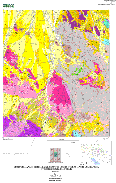
Powell, Robert E. , and Pamela M. Cossette (digital cartography), 2001, Geologic map and digital database of the Conejo Well 7.5 minute quadrangle, Riverside County, California: U.S. Geological Survey Open-File Report 01-31, U.S. Geological Survey, Menlo Park, California.Online Links:
This is a Vector data set. It contains the following vector data types (SDTS terminology):
The map projection used is Polyconic.
Planar coordinates are encoded using coordinate pair
Abscissae (x-coordinates) are specified to the nearest 0.0027666760142
Ordinates (y-coordinates) are specified to the nearest 0.0027666760142
Planar coordinates are specified in Meters
The horizontal datum used is North American Datum of 1927.
The ellipsoid used is Clarke 1866.
The semi-major axis of the ellipsoid used is 6378206.4.
The flattening of the ellipsoid used is 1/294.98.
| Value | Definition |
|---|---|
| Qa | Very young alluvial deposits (late Holocene) |
| Qa2 | Very young alluvial deposits, Unit 2 (late Holocene) |
| Qa1 | Very young alluvial deposits, Unit 1 (late Holocene) |
| Qyai1 | Young alluvial deposits, insensitive source, Unit 1 (middle and (or) early Holocene and (or) latest Pleistocene?) |
| Qyas2,3 | Young alluvial deposits, sensitive source, Units 2 and 3 (late and (or) middle Holocene) |
| Qyas3 | Young alluvial deposits, sensitive source, Unit 3 (late and (or) middle Holocene) |
| Qyas2 | Young alluvial deposits, sensitive source, Unit 2 (late and (or) middle Holocene) |
| Qyaos | Young alluvial deposits, oxidized, sensitive source (Holocene and latest Pleistocene?) |
| Qyaos + Qyas2 | Young alluvial deposits, oxidized, sensitive source + Young alluvial deposits, sensitive source, Unit 2 (Holocene and latest Pleistocene?) |
| Qye? | Young eolian deposits? (Holocene) |
| Qoai3 | Old alluvial deposits, insensitive source, Unit 3 (late Pleistocene) |
| Qoai2 | Old alluvial deposits, insensitive source, Unit 2 (middle? Pleistocene) |
| Qoai1 | Old alluvial deposits, insensitive source, Unit 1 (middle and early Pleistocene) |
| Qoai1? | Old alluvial deposits, insensitive source, Unit 1? (middle and early Pleistocene) |
| Qoaps | Old alluvial deposits, pavemented, sensitive source (late Pleistocene) |
| Qoaos | Old alluvial deposits, oxidized, sensitive source (middle? Pleistocene) |
| Qoars | Old alluvial and (or) regolithic deposits, sensitive source (middle? Pleistocene) |
| Qoc | Old colluvial deposits (Pleistocene) |
| Qoc3 | Old colluvial deposits, Unit 3 (late Pleistocene) |
| Qoc1,2 | Old colluvial deposits, Units 1 and 2 (Pleistocene) |
| Qovork | Old and (or) very old regolithic deposits, cemented (middle? and (or) early Pleistocene) |
| Qvoa | Very old alluvial deposits (middle and early Pleistocene) |
| Qvoa? | Very old alluvial deposits? (middle and early Pleistocene) |
| QTs? | Sedimentary deposits? (Quaternary and (or) Tertiary) |
| QTrcp2 | Regolith, monzogranite of Cottonwood Pass, Unit 2 (Quaternary and Tertiary) |
| QTrrb | Regolith, monzogranite of Red Butte Wash (Quaternary and Tertiary) |
| QTrgd | Regolith, granodiorite (Quaternary and Tertiary) |
| QTrpb | Regolith, granodiorite of Pinto Basin (Quaternary and Tertiary) |
| QTrpb3 | Regolith, granodiorite of Pinto Basin, Unit 3 (Quaternary and Tertiary) |
| QTrpb2 | Regolith, granodiorite of Pinto Basin, Unit 2 (Quaternary and Tertiary) |
| QTrpb1 | Regolith, granodiorite of Pinto Basin, Unit 1 (Quaternary and Tertiary) |
| QTrqm | Regolith, quartz monzonite, monzogranite, and granodiorite (Quaternary and Tertiary) |
| QTrjg | Regolith, granite gneiss of Joshua Tree (Quaternary and Tertiary) |
| QTrp | Regolith, Pinto Gneiss (Quaternary and Tertiary) |
| QTrp? | Regolith, Pinto Gneiss? (Quaternary and Tertiary) |
| Tb | Basalt (late Miocene) |
| KJmgc | Monzogranite, coarse-grained (Cretaceous and (or) Jurassic) |
| KJmgccp | Monzogranite of Cottonwood Pass (Cretaceous or Jurassic) |
| KJmgcrb? | Monzogranite of Red Butte Wash? (Cretaceous or Jurassic) |
| Kgd | Granodiorite (Cretaceous) |
| Kgdpb | Granodiorite of Pinto Basin (Cretaceous) |
| Jqm | Quartz monzonite, monzogranite, and granodiorite (Jurassic) |
| Jqmp | Porphyritic quartz monzonite, monzogranite, and granodiorite (Jurassic) |
| Jmi | Mafic and intermediate intrusive suite (Jurassic) |
| Jmi? | Mafic and intermediate intrusive suite? (Jurassic) |
| TrPmc | Monzodiorite of Munsen Canyon (Triassic or Permian) |
| Prmag | Augen gneiss of Monument Mountain (Middle Proterozoic) |
| Prpgd | Pinto Gneiss, dark (Proterozoic) |
| Prpgd? | Pinto Gneiss, dark? (Proterozoic) |
| Prpq | Quartzite of Pinto Mountain (Middle Proterozoic) |
| Prid | Dolomite of Iron Chief mine (Middle Proterozoic) |
| Pridf | Ferriferous dolomite of Iron Chief mine (Middle Proterozoic) |
| Prjgg | Granite gneiss of Joshua Tree (Middle Proterozoic) |
| Prjmr | Metamorphosed regolith (Middle Proterozoic) |
| TKq? (Tertiary or Cretaceous) | Quartz? |
| TJh? | Hypabyssal intrusive rocks? (Tertiary or Jurassic) |
| Value | Definition |
|---|---|
| Prhgc | Gneiss complex of Hexie Mountains (Proterozoic) |
| Prmag | Augen gneiss of Monument Mountain (Middle Proterozoic) |
| Prmg | Porphyritic granodiorite, monzogranite, and augen gneiss of Monument Mountain (Middle Proterozoic) |
| Prpg | Pinto Gneiss of Miller, 1938 (Proterozoic) |
| Prpgd | Pinto Gneiss, dark (Proterozoic) |
| Prpq | Quartzite of Pinto Mountain (Middle Proterozoic) |
| Prid | Dolomite of Iron Chief mine (Middle Proterozoic) |
| Pridf | Ferriferous dolomite of Iron Chief mine (Middle Proterozoic) |
| Prjgg | Granite gneiss of Joshua Tree (Middle Proterozoic) |
| Prjmr | Metamorphosed regolith, granite gneiss of Joshua Tree (Middle Proterozoic) |
| Prjg | Porphyritic granite and granite gneiss of Joshua Tree (Middle Proterozoic) |
| Prems | Metasedimentary rocks of Eagle Mountains (Middle Proterozoic) |
| Pre | Eagle Mountains assemblage (Middle Proterozoic) |
| Value | Definition |
|---|---|
| Qovork | Old and (or) very old regolithic deposits, cemented (middle? Pleistocene) |
| QTr | Regolith (Quaternary and Tertiary) |
| QTrcp | Regolith, monzogranite of Cottonwood Pass (Quaternary and Tertiary) |
| QTrcp2 | Regolith, monzogranite of Cottonwood Pass, Unit 2 (Quaternary and Tertiary) |
| QTrrb | Regolith, monzogranite of Red Butte Wash (Quaternary and Tertiary) |
| QTrmgc | Regolith, coarse-grained monzogranite (Quaternary and Tertiary) |
| QTrgd | Regolith, granodiorite (Quaternary and Tertiary) |
| QTrpb | Regolith, granodiorite of Pinto Basin (Quaternary and Tertiary) |
| QTrpb3 | Regolith, granodiorite of Pinto Basin, Unit 3 (Quaternary and Tertiary) |
| QTrpb2 | Regolith, granodiorite of Pinto Basin, Unit 2 (Quaternary and Tertiary) |
| QTrpb1 | Regolith, granodiorite of Pinto Basin, Unit 1 (Quaternary and Tertiary) |
| QTrqm | Regolith, quartz monzonite, monzogranite, and granodiorite (Quaternary and Tertiary) |
| QTrjg | Regolith, granite gneiss of Joshua Tree (Quaternary and Tertiary) |
| QTrp | Regolith, Pinto Gneiss (Quaternary and Tertiary) |
| Prjmr | Metamorphosed regolith (Middle Proterozoic) |
| Value | Definition |
|---|---|
| KJmgc | Monzogranite, coarse-grained (Cretaceous and (or) Jurassic) |
| KJmgccp | Monzogranite of Cottonwood Pass (Cretaceous or Jurassic) |
| KJmgcrb | Monzogranite of Red Butte Wash (Cretaceous or Jurassic) |
| Kgd | Granodiorite (Cretaceous) |
| Kgdpb | Granodiorite of Pinto Basin (Cretaceous) |
| Jipe | Intrusive suite of Pinto and Eagle Mountains (Jurassic) |
| Jqm | Quartz monzonite, monzogranite, and granodiorite (Jurassic) |
| Jqmp | Porphyritic quartz monzonite, monzogranite, and granodiorite (Jurassic) |
| Jmi | Mafic and intermediate intrusive suite (Jurassic) |
| TrPmc | Monzodiorite of Munsen Canyon (Triassic or Permian) |
| Mzb | Batholith of Transverse Ranges and Mojave Desert (Mesozoic) |
| Mzbc | Batholith of Transverse Ranges and Mojave Desert, central belt (Mesozoic) |
| Mzbe | Batholith of Transverse Ranges and Mojave Desert, eastern belt (Mesozoic) |
| Prmag | Augen gneiss of Monument Mountain (Middle Proterozoic) |
| Prmg | Porphyritic granodiorite, monzogranite, and augen gneiss of Monument Mountain (Middle Proterozoic) |
| Prjgg | Granite gneiss of Joshua Tree (Middle Proterozoic) |
| Prjg | Porphyritic granite and granite gneiss of Joshua Tree (Middle Proterozoic) |
| Prpgg | Porphyritic granitoids and augen gneiss (Middle Proterozoic) |
| Value | Definition |
|---|---|
| Qa | Very young alluvial deposits (late Holocene) |
| Qa2 | Very young alluvial deposits, Unit 2 (late Holocene) |
| Qa1 | Very young alluvial deposits, Unit 1 (late Holocene) |
| Qya | Young alluvial deposits (Holocene and latest Pleistocene?) |
| Qyai | Young alluvial deposits, insensitive source (Holocene and latest Pleistocene?) |
| Qyai1 | Young alluvial deposits, insensitive source, Unit 1 (middle and (or) early Holocene and (or) latest Pleistocene?) |
| Qyas | Young alluvial deposits, sensitive source (Holocene and latest Pleistocene?) |
| Qyas2,3 | Young alluvial deposits, sensitive source, Units 2 and 3 (late and (or) middle Holocene) |
| Qyas3 | Young alluvial deposits, sensitive source, Unit 3 (late and (or) middle Holocene) |
| Qyas2 | Young alluvial deposits, sensitive source, Unit 2 (late and (or) middle Holocene) |
| Qyaos | Young alluvial deposits, oxidized, sensitive source (Holocene and latest Pleistocene?) |
| Qyaos + Qyas2 | Young alluvial deposits, oxidized, sensitive source + Young alluvial deposits, sensitive source, Unit 2 (Holocene and latest Pleistocene?) |
| Qye? | Young eolian deposits? (Holocene) |
| Qoa | Old alluvial deposits (Pleistocene) |
| Qoai | Old alluvial deposits, insensitive source (Pleistocene) |
| Qoai3 | Old alluvial deposits, insensitive source, Unit 3 (late Pleistocene) |
| Qoai2 | Old alluvial deposits, insensitive source, Unit 2 (middle? Pleistocene) |
| Qoai1 | Old alluvial deposits, insensitive source, Unit 1 (middle and early Pleistocene) |
| Qoas | Old alluvial deposits, sensitive source (Pleistocene) |
| Qoaps | Old alluvial deposits, pavemented, sensitive source (late Pleistocene) |
| Qoaos | Old alluvial deposits, oxidized, sensitive source (middle? Pleistocene) |
| Qoars | Old alluvial and (or) regolithic deposits, sensitive source (middle? Pleistocene) |
| Qoc | Old colluvial deposits (Pleistocene) |
| Qoc3 | Old colluvial deposits, Unit 3 (late Pleistocene) |
| Qoc1,2 | Old colluvial deposits, Units 1 and 2 (Pleistocene) |
| Qoua | Old and very old alluvial deposits (Pleistocene) |
| Qovork | Old and (or) very old regolithic deposits, cemented (middle? Pleistocene) |
| Qvoa | Very old alluvial deposits (middle and early Pleistocene) |
| QTs? | Sedimentary deposits? (Quaternary and (or) Tertiary) |
| Qyua | Very young and young alluvial deposits (Holocene) |
| Prid | Dolomite of Iron Chief mine (Middle Proterozoic) |
| Pridf | Ferriferous dolomite of Iron Chief mine (Middle Proterozoic) |
| Prpq | Quartzite of Pinto mountain (Middle Proterozoic) |
| Prs | Sedimentary rocks (Proterozoic) |
| Value | Definition |
|---|---|
| TKq? | Quartz? (Tertiary or Cretaceous) |
| Value | Definition |
|---|---|
| Tb | Basalt (Miocene) |
| TJh? | Hypabyssal intrusive rocks? (Tertiary or Jurassic) |
| Value | Definition |
|---|---|
| TKdp | Dacite porphyry dike (Tertiary or Cretaceous) |
| TJd | Dike (Tertiary?, Cretaceous, or Jurassic) |
| Jql | Quartz latite dike (Jurassic) |
| Kap | Aplite dike (Cretaceous) |
Geologic mapping, topical studies, and digital preparation for this report were sponsored jointly by the following: (1) the National Cooperative Geologic Mapping Program of the U.S. Geological Survey, (2) California Division of Mines and Geology, and (3) the National Park Service (Joshua Tree National Park).
This database was prepared in the GIS laboratory at the Spokane Field Office of the USGS in Spokane, Washington. The facility is maintained primarily by the Mineral Resource Surveys Program and supported in part by the National Geologic Mapping Program. We thank Paul C. Hyndman and Steven R. Munts in Spokane and Rachel Hauser Alvarez of the SCAMP GIS laboratory at the University of California, Riverside for their assistance in solving problems encountered during digital preparation of the data set.
Technical review by Fred K. Miller has led to significant improvements in the database and in the map plot file. David R. Bedford has examined the digital database file for internal logical consistency, has reviewed the metadata file, and has tested the viability of digital products.
(509) 368-3120 (voice)
(509) 368-3199 (FAX)
rpowell@usgs.gov
The data set for the Conejo Well quadrangle has been prepared by the Southern California Areal Mapping Project (SCAMP), a cooperative project sponsored jointly by the U.S. Geological Survey and the California Division of Mines and Geology. The Conejo Well data set represents part of an ongoing effort to create a regional GIS geologic database for southern California. This regional digital database, in turn, is being developed as a contribution to the National Geologic Map Database of the National Cooperative Geologic Mapping Program of the USGS. The Conejo Well database has been prepared in cooperation with the National Park Service as part of an ongoing project to provide Joshua Tree National Park with a geologic map base for use in managing Park resources and developing interpretive materials.
The digital geologic map database for the Conejo Well quadrangle has been created as a general-purpose data set that is applicable to land-related investigations in the earth and biological sciences. Along with geologic map databases in preparation for adjoining quadrangles, the Conejo Well database has been generated to further our understanding of bedrock and surficial processes at work in the region and to document evidence for seismotectonic activity in the eastern Transverse Ranges. The database is designed to serve as a base layer suitable for ecosystem and mineral resource assessment and for building a hydrogeologic framework for Pinto Basin.
Powell, Robert E. , 2001, Geologic map and digital database of the Porcupine Wash 7.5 minute quadrangle, Riverside County, California: U.S. Geological Survey Open-File Report 01-30, U.S. Geological Survey, Menlo park, California.Online Links:
This initial version of the Conejo Well geologic map database relies extensively on interpretation of aerial photographs; field study of bedrock units was conducted in the context of smaller-scale regional mapping and field study of surficial deposits has been minimal. The map represents the state of knowledge for the quadrangle and provides a basis for gathering additional field data to resolve questions raised in making the map. Attributes assigned to regions, polygons, lines, and points in the Conejo Well database are reasonably accurate as determined by the normal range of checks and balances applied in making a geologic map by a combination of hands-on and remote field observation, sampling, and interpretation of aerial photographs. Additional field investigation, however, is required to verify the accuracy of polygon (map unit) attributes and to establish relations among units. Where anomalous descriptive characteristics lead to particular uncertainty of unit assignment of a polygon, a question mark (?) is appended to the unit label. In the Conejo Well quadrangle, this device has been used chiefly for unit assignments of unvisited polygons that appear anomalous on aerial photographs.
Until uniform National geologic map accuracy standards are
developed and adopted by the U.S. Geological Survey in
cooperation with various state geological agencies, the SCAMP
project has proposed interim map-accuracy standards for
1:24,000-scale geologic maps produced by the project. For
mapping compiled on USGS 1:24000-scale topographic maps,
geologic lines and points on SCAMP geologic maps are judged
to meet the map-accuracy standard if they are located to
within 15 meters of their position relative to topographic or
cultural features on the topographic base map. In mapping on
USGS digital orthophotographs in the desert of southern
California, however, points and exposed, sharply defined
linear features are readily located to within 10 m, or even 5
m.
Linear features in the Conejo Well geologic map database are
represented as solid, dashed, and dotted lines. Using the
DOQQ base, points and linear features represented by solid
lines are located to within 10 m or less of their position on
the ground. Linear features represented as dashed lines may
or may not be located to within 10 m of their position on the
ground. Linear features represented by dotted lines are
concealed beneath overlying mapped units. The accuracy of the
various lines is identified in the digital database as well
as on the geologic-map plot.
Contacts between lithologic domains that make up surficial
deposits as mapped on the DOQQs typically are readily located
to within 10 m, but to make domains that can be resolved at
1:24,000 contacts are often drawn by approximating the
dominant unit on a percentage basis. Interspersal of well-
and approximately located contacts is common among the many
hundreds of contact segments present in the Conejo Well
quadrangle. Given that many quadrangles are being mapped in a
relatively short time interval, it was deemed too
time-consuming to distinguish well-located and approximately
located contacts between surficial deposits; therefore, all
surficial contacts are represented as approximately located
and shown with a dashed line symbol.
The geologic map and digital database of the Conejo Well 7.5 minute quadrangle contain new data that have been subjected to rigorous review and are a substantially complete representation of the current state of knowledge concerning the geology of the quadrangle.
Polygon and chain-node topology present.
The areal extent of the map is represented digitally by an
appropriately projected (Polyconic projection),
mathematically generated box. Consequently, polygons
intersecting the lines that comprise the map boundary are
closed by that boundary. Polygons internal to the map
boundary are completely enclosed by line segments which are
themselves a set of sequentially numbered coordinate pairs.
Point data are represented by coordinate pairs.
Are there legal restrictions on access or use of the data?
- Access_Constraints: None
- Use_Constraints:
- Spatial Resolution. Use of this digital geologic map should not violate the spatial resolution of the data. The Conejo Well geologic map and database was developed using digital orthophotograph quarter quadrangles (DOQQs) as a base. DOQQs have a pixel resolution of 1 m and are accurate to a scale of 1:12,000 (1 in = 1,000 ft). Any enlargement beyond 1:12,000 exceeds the spatial resolution of the geologic data and should not be used in lieu of a more detailed site-specific geologic evaluation. Similarly, the digital topographic base map is derived from the U.S. Geological Survey, 1:24,000-scale Conejo Well 7.5 minute quadrangle (provisional edition, 1986); any enlargement beyond 1:24,000 exceeds the spatial resolution of the topographic data. Plotting or viewing of the data at scales larger than 1:12,000 on the DOQQ base, or larger than 1:24,000 on the topographic base, will not yield greater real detail, although it may reveal fine-scale irregularities below the intended resolution of the database. Where the geologic data is used in combination with the topographic data, the resolution of the combined output is limited by the lower resolution of the topographic data. Where this database is used in combination with other data of higher resolution, the resolution of the combined output will be limited by the lower resolution of these data.
Content. This database, identified as "Geologic map and digital database of the Conejo Well 7.5 minute quadrangle, Riverside County, California" has been approved for release and publication by the Director of the U.S. Geological Survey. Although this database has been subjected to rigorous review and is substantially complete, the USGS reserves the right to revise the data pursuant to further analysis and review. Furthermore, it is released on the condition that neither the USGS nor the United States Government may be held responsible for any damages resulting from its authorized or unauthorized use. This database is preliminary and has not been reviewed for conformity with U.S. Geological Survey editorial standards or with the North American Stratigraphic Code. Any use of trade, product, or firm names is for descriptive purposes only and does not imply endorsement by the U.S. Government.
Faults. The Conejo Well database is sufficiently detailed to identify and characterize many actual and potential geologic hazards represented by faults, but it is not sufficiently detailed for site-specific determinations or evaluations of these features. Faults shown do not take the place of fault-rupture hazard zones designated by the California State Geologist (see, for example, Hart, 1988; Hart and Bryant, 1997).
Hart, E. W., 1988, Fault-rupture zones in California; Alquist-Priolo Special Studies Zones Act of 1972 with index to special studies zones maps (revised, 1988): California Division of Mines and Geology Special Publication 42.
Hart, E. W., and Bryant, W.A., 1997, Fault-rupture zones in California; Alquist-Priolo Special Studies Zones Act of 1972 with index to special studies zones maps (revised, 1997): California Division of Mines and Geology Special Publication 42.
303-202-4700 (voice)
303-202-4693 (FAX)
The U.S. Geological Survey (USGS) provides these geographic data "as is." The USGS makes no guarantee or warranty concerning the accuracy of information contained in the geographic data. The USGS further makes no warranties, either expressed or implied as to any other matter whatsoever, including, without limitation, the condition of the product, or its fitness for any particular purpose. The burden for determining fitness for use lies entirely with the user. Although these data have been processed successfully on computers at the USGS, no warranty, expressed or implied, is made by the USGS regarding the use of these data on any other system, nor does the fact of distribution constitute or imply any such warranty.
In no event shall the USGS have any liability whatsoever for payment of any consequential, incidental, indirect, special, or tort damages of any kind, including, but not limited to, any loss of profits arising out of use of or reliance on the geographic data or arising out of delivery, installation, operation, or support by USGS.
This digital, geologic map database of the Conejo Well 7.5 minute quadrangle, and any derivative maps thereof, is not meant to be used or displayed at any map scale larger than 1:12,000 on the DOQQ base or 1:24,000 on the topographic base.
509-368-3123 (voice)
509-368-3199 (FAX)
pcossette@usgs.gov

![]() U.S. Department of the Interior |
U.S. Geological Survey
U.S. Department of the Interior |
U.S. Geological Survey
URL: http://geo-nsdi.er.usgs.gov/metadata/open-file/01-31/metadata.faq.html
Page Contact Information: Peter Schweitzer
Page Last Modified: Monday, 10-Nov-2008 12:18:52 EST
