![[!]](http://pa.water.usgs.gov/images/exclaim.gif) During cold weather, ice effects on stage and discharge determinations
at some stream-gaging stations are likely. Data values reported on
these pages may be significantly higher or lower than actual
streamflow. Adjustment of data for ice effects can only be done after
detailed analysis. Users are encouraged to contact this office for more
information on specific stream-gaging stations.
During cold weather, ice effects on stage and discharge determinations
at some stream-gaging stations are likely. Data values reported on
these pages may be significantly higher or lower than actual
streamflow. Adjustment of data for ice effects can only be done after
detailed analysis. Users are encouraged to contact this office for more
information on specific stream-gaging stations.
PROVISIONAL DATA SUBJECT TO REVISION
NOTICE (09/03/2008) -- After
September 30, 2008, data collection at this streamgage may be
discontinued due to funding reductions from partner agencies. Although
historic data will remain accessible, no new data will be collected
unless one or more new funding partners are found. Users who can
contribute funding to continue operation of this streamgage should
contact Bob Hainly of the USGS Pennsylvania Water Science Center at
(717-730-6971, rahainly@usgs.gov).
NOTICE (10/01/2008) -- Data collection and
real-time data delivery at this streamgage will be continued while
active funding negotiations are underway with several
parties.
NOTICE (11/26/2008) -- Data
collection and real-time data delivery from this streamgage will be
continued through September 30, 2009, as a result of funding received
from the Pennsylvania Department of Environmental Protection. Funding
for operation of equipment at this site is uncertain beyond September
2009.
 STATION.--01570500 SUSQUEHANNA RIVER AT
HARRISBURG, PA
STATION.--01570500 SUSQUEHANNA RIVER AT
HARRISBURG, PALOCATION.--Lat 40`15'17", long 76`53'11", Dauphin County, Hydrologic Unit 02050305, on east bank of City Island, 60 ft downstream from Market Street bridge in Harrisburg, 3,670 ft upstream from sanitary dam, and 1.7 mi upstream from Paxton Creek.
DRAINAGE AREA.--24,100 mi2.
PERIOD OF RECORD.--October 1890 to current year.
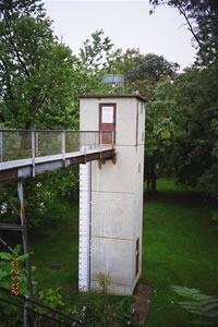
GAGE.--Water-stage recorder. Concrete control since Aug. 29, 1916. Datum of gage is 290.01 ft above National Geodetic Vertical Datum of 1929. Prior to Oct. 1, 1928, nonrecording gage at Walnut Street Bridge 600 ft upstream, and Oct. 1, 1928, to Aug. 31, 1975, water-stage recorder at site 3,170 ft downstream, all gages at same datum.
EXTREMES OUTSIDE PERIOD OF RECORD.--Maximum stage known during period 1786 to 1890, 26.8 ft at Walnut Street bridge, June 2, 1889, discharge, 654,000 ft3/s.
FLOOD STAGE.--NOAA, National Weather Service river forecast station flood stage provided to USGS April 1999 is 17 feet.
COOPERATION.--Funding for the operation of this station is provided by the Federal Energy Regulatory Commission, the U.S. Army Corps of Engineers, the Pennsylvania Department of Environmental Protection, and the U.S. Geological Survey.


